

Gallery And Blog Underneath


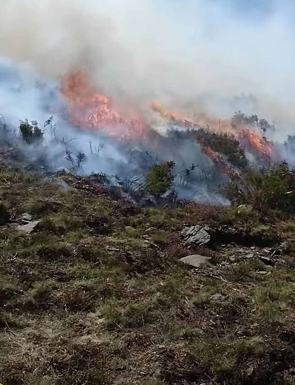
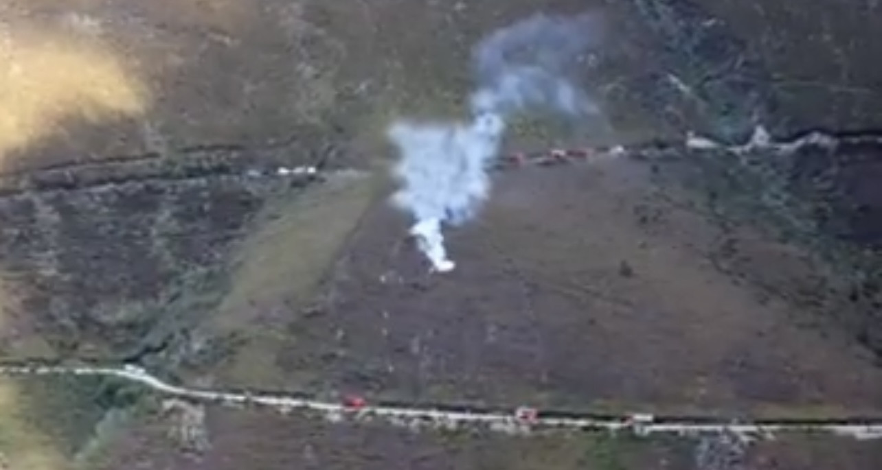
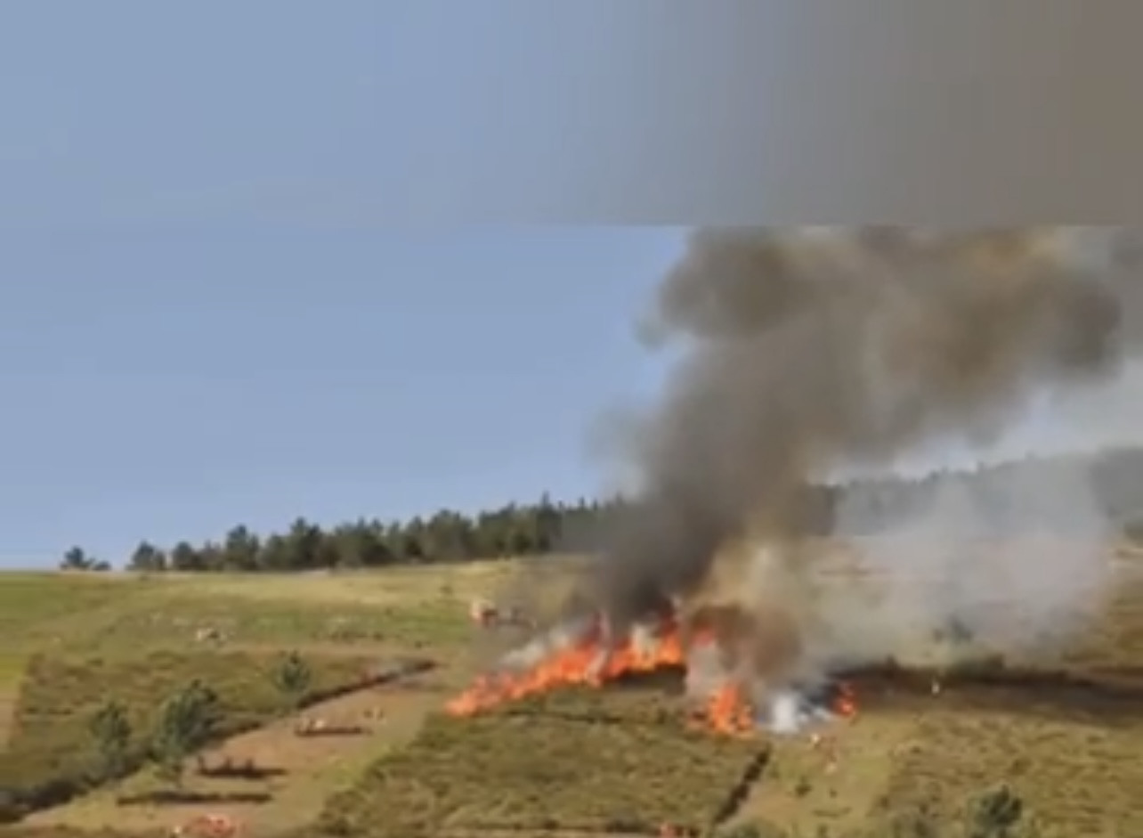
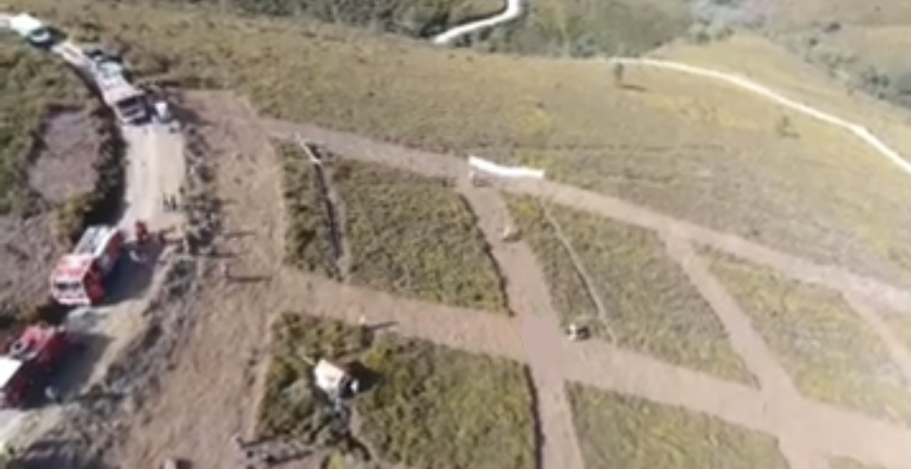
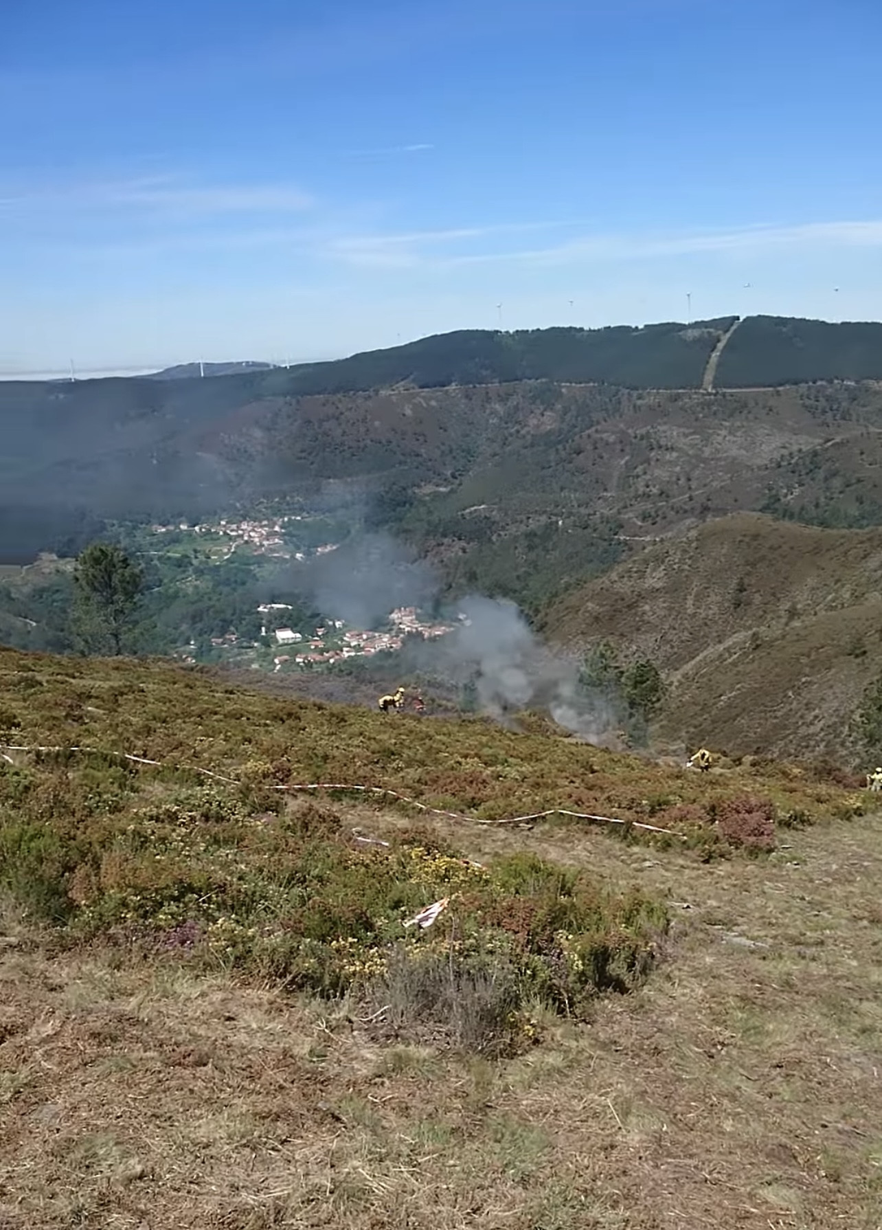
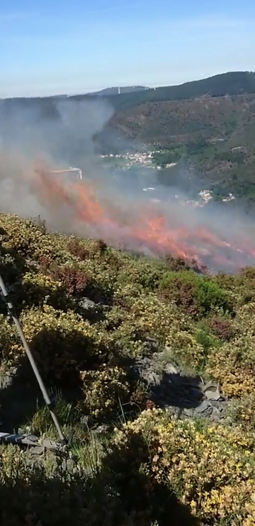
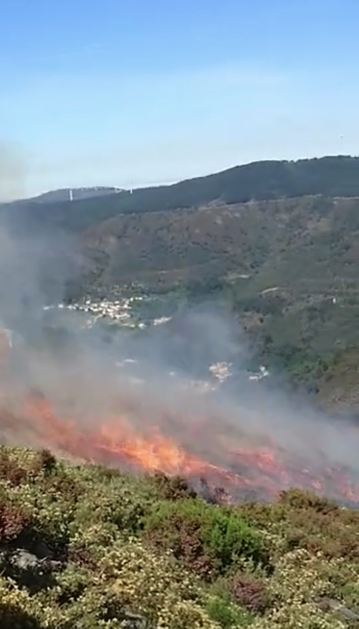
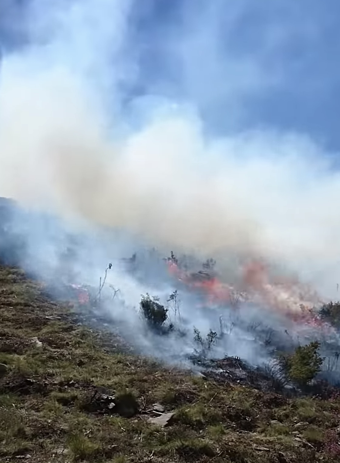


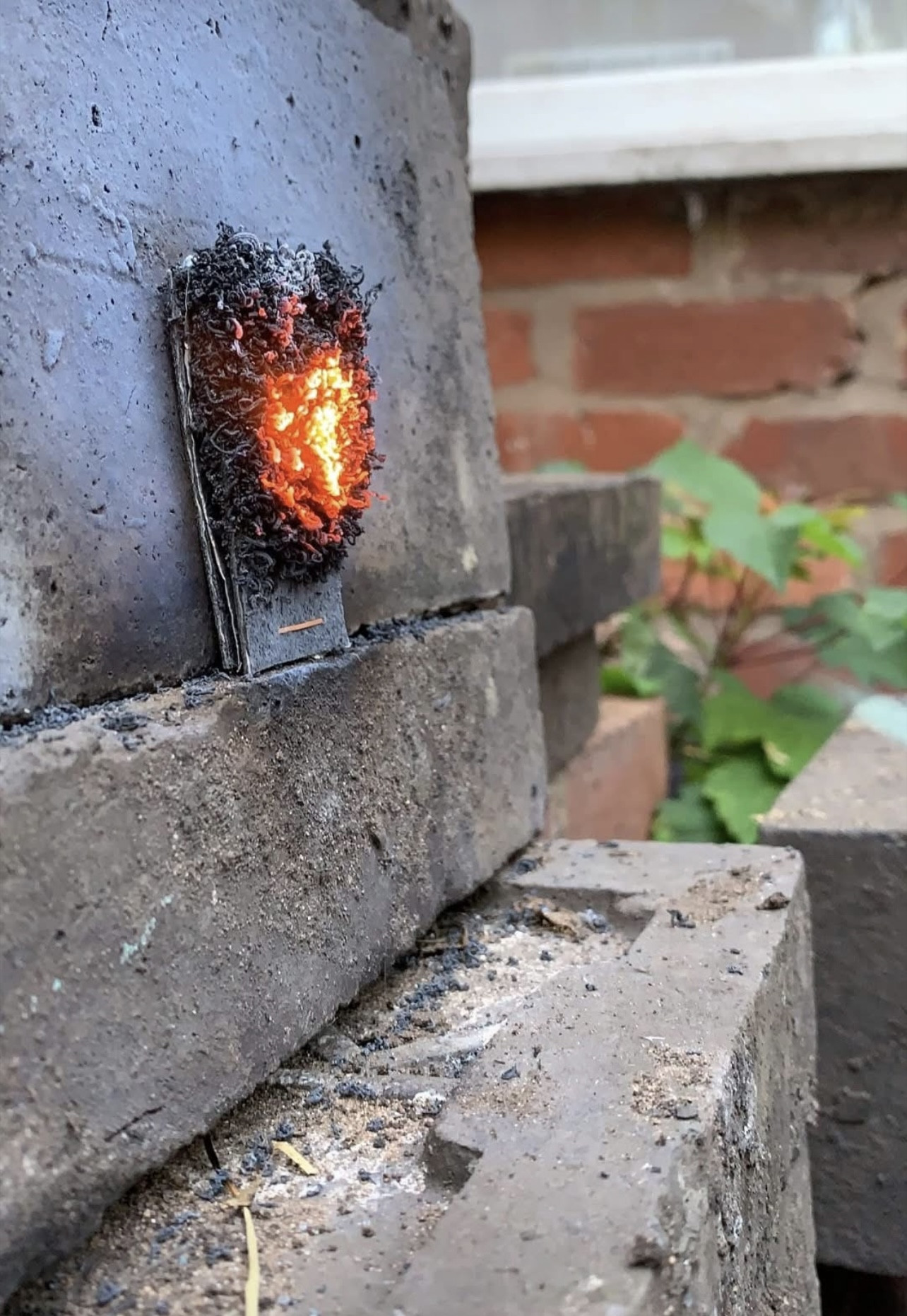
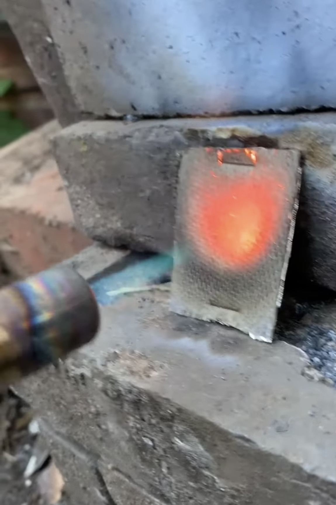
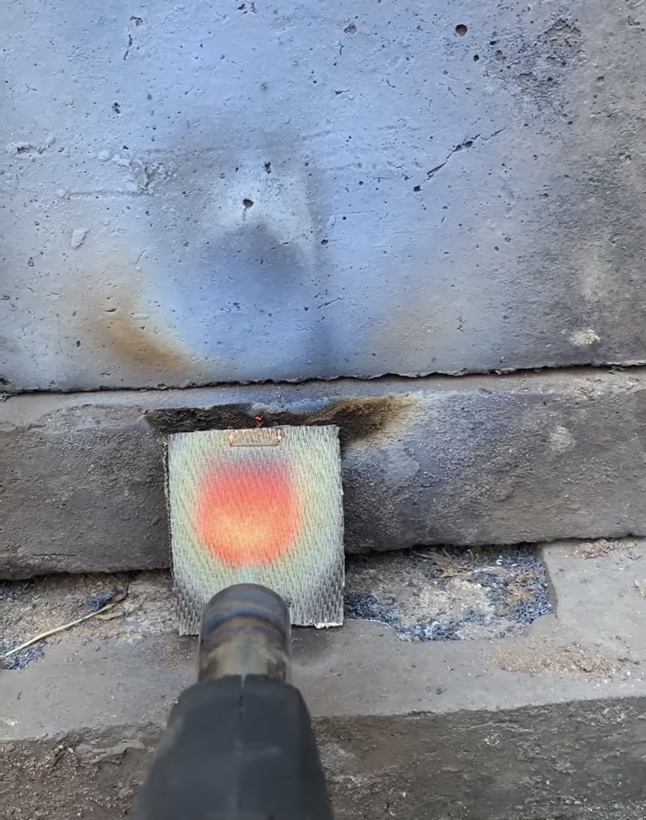
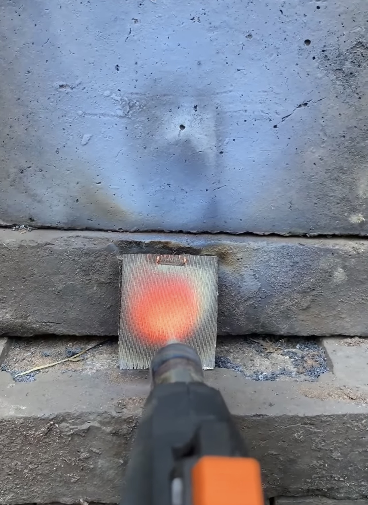
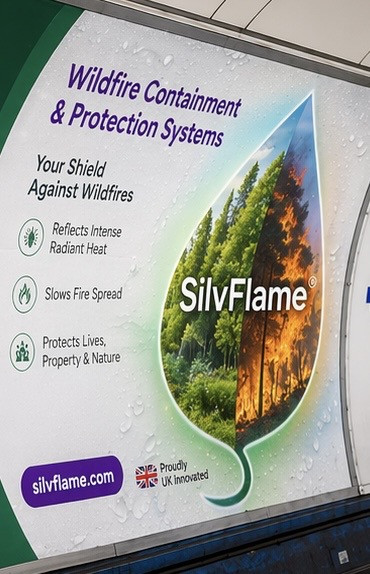


"When tempted to fight fire with fire, remember that the Fire Department usually uses water"
Dana Barzilay
BLOG

Blog 1
Future Wildfires in Ukraine: Building Resilient Ecosystems and Advanced Wildfire Containment and Protection in a Changing Climate
Wildfires are increasingly recognised as one of the most significant environmental and socio-economic threats of the twenty-first century.
Across the globe, extreme fire events have devastated forests, wildlife habitats, infrastructure, and communities, from the Amazon Basin and Australia to Siberia and North America.
Ukraine is similarly affected, with a growing frequency of large-scale wildfires driven by climate change, prolonged droughts, ecosystem degradation, and human activity.
Particular international concern has focused on fires within the Chornobyl Exclusion Zone (CEZ), one of the most contaminated terrestrial environments on Earth following the 1986 nuclear disaster.
While radiological risks to populations outside the zone remain low according to scientific assessments, wildfires in this region present unique environmental challenges due to the potential remobilisation of radionuclides stored in vegetation, forest litter, and surface soils.
Recent events, particularly the 2026 wildfire triggered by drone crashes in the CEZ, highlight the increasing complexity of wildfire management in Ukraine.
These developments underscore the urgent need for integrated strategies that combine ecosystem restoration, climate adaptation, modern fire management, and advanced protection technologies.
Wildfire Activity in Ukraine and the Chornobyl Exclusion Zone Wildfires have become a recurring feature of Ukraine’s landscapes and the approximately 5,000 km² Chornobyl Exclusion Zone. Since the early 1990s, more than 1,250 fires have been recorded in the CEZ, with notable large-scale events in 1992, 2010, 2015, 2020, and 2026.
The 2026 event began after the crash of two drones, igniting a major forest fire that rapidly spread across approximately 1,200 hectares (about 2,965 acres) and ultimately affected up to 12 square kilometres of land.
The fire occurred under dry, windy conditions and was further complicated by landmines, which significantly hindered firefighting efforts. Although brought largely under control within days, emergency services reported sustained challenges due to environmental and safety constraints.
Earlier, the spring 2020 wildfires were among the largest recorded fire events in the exclusion zone, affecting vast areas of forest, including parts of the highly contaminated Red Forest.
That event underscored how extreme weather conditions—combined with flammable vegetation and limited accessibility—can drive rapid fire spread across contaminated landscapes.
Key contributing factors to wildfire risk in Ukraine and the CEZ include:
Increasing frequency of droughts and rising temperatures linked to climate change Extensive pine monoculture plantations with high flammability Accumulation of dead vegetation and forest litter
Reduced decomposition in contaminated soils Human ignition sources, including arson, agricultural burning, and accidental fires Restricted access and limited firefighting infrastructure in remote or hazardous areas Together, these conditions create an environment highly susceptible to large, fast-moving wildfires.
Radiological and Environmental Consequences
Wildfires in the CEZ are distinct from typical forest fires because they can remobilise radioactive contaminants such as caesium-137, strontium-90, and plutonium isotopes.
Research has shown that burning vegetation and topsoil can release these radionuclides into the atmosphere, where they may be transported locally or over long distances depending on weather conditions.
Studies by V.I. Yoschenko and colleagues demonstrate that wildfires can significantly increase the mobility of radionuclides, particularly when combustion temperatures are high and contaminated biomass or soil is involved.
However, environmental monitoring consistently indicates that radiation doses to populations outside the exclusion zone remain extremely low and well below levels considered harmful to human health.
Even during major fire events, detected increases in atmospheric radioactivity are generally minor compared to levels observed immediately after the 1986 disaster.
The environmental impacts of wildfires in contaminated zones include:
. Destruction of wildlife habitats
. Disruption of food chains and ecosystem processes
. Increased soil erosion and land degradation
. Redistribution of radionuclides through ash and smoke
. Potential changes in radionuclide mobility and bioavailability
These effects may become more pronounced as climate change intensifies fire regimes globally.
Mechanisms of Radioactive Dispersion
The spread of radioactive material during wildfires depends on several interacting factors:
. Fire size and burned area
. Radionuclide concentration in vegetation and surface soils
. Moisture content of biomass and soil
. Fire intensity and combustion temperature
. Meteorological conditions, particularly wind and precipitation
Larger particles typically settle close to the fire zone, while finer particles can be transported over long distances.
Dry conditions enhance atmospheric dispersion, whereas rainfall can remove radionuclides from the air and deposit them elsewhere, potentially causing secondary contamination.
Frequency and Scale of Fire Events
Forest fires occur regularly within and around the CEZ. Between 1993 and 2010, more than 1,000 fire incidents were recorded. While most were relatively small, approximately 9% exceeded 100 km² in the burned area.
Examples include:
Steppe fires in 1992 with minor detectable radionuclide dispersion Multiple fires between 2010 and 2017 with limited or no measurable radiological impact outside the region The extensive 2020 fires, driven by extreme drought and heat, which nonetheless resulted in no significant health risks to populations outside the zone These patterns illustrate both the frequency of ignition events and the variability in their environmental impact.
Environmental Legacy of the Chornobyl Disaster
The 1986 Chornobyl nuclear accident caused widespread and long-term ecological contamination affecting forests, wildlife, soils, and aquatic systems.
In the immediate aftermath, large-scale mortality occurred in coniferous forests, soil invertebrates, and mammals, along with reduced reproductive success across multiple species.
The Red Forest, one of the most heavily affected areas, lost approximately 400 hectares of pine woodland. Overall, radiation impacts extended across tens of thousands of hectares.
A continuing environmental concern is the decomposition of contaminated organic matter, which may gradually transfer radionuclides into groundwater systems.
Wildfires exacerbate this risk by reintroducing previously deposited contaminants into the atmosphere and redistributing them through wind and precipitation.
Ecosystem Recovery and Biodiversity Trends
Despite severe initial impacts, the CEZ has undergone significant ecological recovery over the past decades.
The absence of permanent human activity has allowed ecosystems to regenerate, resulting in one of Europe’s largest unintended wildlife reserves.
Studies indicate that while radiation initially caused ecological damage, long-term reductions in human disturbance have supported substantial biodiversity gains.
Camera-trap studies and field observations have documented the return of numerous species, including the Eurasian lynx and European bison.
Ecologists such as Professor Nick Beresford have noted that wildlife populations have shown strong recovery trends despite persistent radiation exposure.
Similarly, research by plant biochemist Stuart Thompson suggests that the ecological benefits of human absence may, in some areas, outweigh the negative effects of radiation.
However, ongoing research continues to examine the long-term effects of chronic low-dose radiation exposure on wildlife health, genetics, and population stability.
Building Resilient Ecosystems for the Future
Reducing wildfire risk in Ukraine requires long-term ecological and land management strategies focused on resilience and adaptation.
Climate-Adaptive Forestry
Transitioning from single-species pine plantations to mixed, native, uneven-aged forests can reduce flammability, improve moisture retention, and enhance ecosystem stability.
Protection of Old-Growth Forests
Old-growth ecosystems provide natural fire resistance and serve as critical reservoirs of biodiversity.
Strengthening legal protection for these areas is essential for long-term resilience.
Wetland and Peatland Restoration
Restoring wetlands, particularly in regions such as Polissia, improves water retention, reduces fire risk, and enhances biodiversity and agricultural resilience.
Landscape Diversification
Creating mosaics of forests, wetlands, grasslands, and natural habitats reduces continuous fuel loads and limits the spread of large-scale fire fronts.
Modern Fire Containment and Protection Technologies
Alongside ecological restoration and climate adaptation measures, advanced wildfire management technologies are becoming increasingly essential for rapid response, risk reduction, and the protection of critical infrastructure.
Integrated platforms such as Silvflame represent a modern approach to wildfire resilience by combining containment systems, evacuation support, and infrastructure defence into a coordinated operational framework.
Key System Components
*SF - SwiftShield: Rapid-deployment containment barriers designed to quickly establish firebreaks and limit the spread of wildfires, enabling more efficient suppression efforts.
*SF - SafeRoute: Protected evacuation corridor systems that enhance civilian and emergency services safety by maintaining secure, fire-resistant escape routes during emergencies.
*SF - StaticDefender: Long-term passive protection solutions for communities, industrial sites, and sensitive environments, offering continuous defence against flame fronts, radiant heat, and embers.
*SF - CriticalDefender: Targeted protection systems for essential infrastructure, including power stations, water treatment facilities, telecommunications networks, emergency services, and transport hubs, ensuring operational continuity during wildfire events.
*SF - FlameShield Extender: Modular containment technology that expands protective barriers around high-risk zones and active fire perimeters, allowing flexible deployment in complex terrain.
*SF - Security Fence Wildfire Stopper (Integrated Sprinkler System): A hybrid barrier system combining fire-resistant materials with active suppression technology to form a reinforced defensive perimeter around vulnerable assets.
*SF - WaterMortar: A long-range, precision wildfire suppression system designed to deliver targeted water application for efficient fire control in difficult-to-access areas.
Integrated Role in Wildfire Management
These technologies complement broader ecological and land management strategies by strengthening real-time response capacity and reducing the likelihood of uncontrolled wildfire escalation.
When integrated with nature-based solutions and adaptive landscape planning, such systems contribute to a more comprehensive wildfire resilience framework.
In combination, ecological restoration efforts and advanced wildfire protection technologies, such as the Silvflame platform, offer a holistic approach to risk reduction—helping lower wildfire severity, enhance climate resilience, protect critical infrastructure, and support the development of safer, more sustainable landscapes.
National Context and Risk Outlook
According to the State Emergency Service of Ukraine, more than 11,000 ecosystem fires were recorded in the first four months of 2026 alone, highlighting the increasing pressure on emergency systems and the importance of prevention and preparedness.
Government agencies continue to emphasise public awareness, early response, and reliance on official guidance during high-risk fire seasons.
Conclusion
Ukraine’s wildfire challenge reflects a complex interaction between climate change, ecosystem vulnerability, and human influence.
The Chornobyl Exclusion Zone exemplifies these dynamics, where wildfire risk intersects with long-term radiological contamination.
Recent events, including the 2026 drone-related fire, demonstrate that wildfire threats are likely to intensify under increasingly dry and unstable climatic conditions.
At the same time, the CEZ illustrates how ecosystems can recover significantly in the absence of human disturbance, despite ongoing environmental risks.
Addressing future wildfire risk requires a dual strategy: restoring resilient, climate-adapted ecosystems while deploying advanced fire detection, containment, and protection technologies.
By integrating nature-based solutions with modern wildfire management systems, Ukraine can strengthen its resilience, protect critical infrastructure, and support long-term ecological stability in a changing climate.
————————————————————————————————————————————————————
Blog 2

————————————————————————————————————————————————————
Blog 3

Post-Wildfire Landslides, Rockfalls and Flood Risk
Managing Secondary Hazards Following Wildfires
The impacts of wildfires extend far beyond the immediate burn area. In addition to damaging ecosystems, infrastructure, and communities, severe wildfires can trigger secondary hazards such as landslides, rockfalls, flooding, and debris flows. These risks may emerge shortly after a fire or persist for many years as affected landscapes recover.
As climate change contributes to more frequent and intense wildfires through rising temperatures, prolonged droughts, and changing weather patterns, understanding and managing post-fire hazards has become an increasingly important aspect of wildfire resilience and land management.
Post-Fire Slope Instability
Healthy forests play a vital role in stabilising slopes and regulating water movement throughout a landscape. When wildfire removes vegetation and damages root systems, hillsides become significantly more vulnerable to erosion, landslides, and debris flows.
One of the most dangerous post-fire hazards is the development of rapid debris flows. Triggered by intense rainfall, these events can occur weeks, months, or even years after a wildfire and often strike with little warning. As fire-damaged root systems decay over time, soil cohesion decreases, further increasing the likelihood of slope failure.
Post-fire debris flows can:
Exert substantial impact forces on buildings and infrastructure.
Strip vegetation and valuable topsoil from hillsides.
Block rivers, streams, and drainage channels.
Damage roads, bridges, utilities, and public infrastructure.
Threaten human life and community safety.
Causes significant long-term environmental degradation.
In some circumstances, wildfire can also reactivate or destabilise existing deep-seated landslides, creating ongoing geotechnical challenges for landowners, land managers, and local authorities.
The Protective Role of Forests
Forests provide one of nature’s most effective forms of slope protection. Tree root systems reinforce soil structure, increase stability, reduce erosion, and help prevent shallow landslides.
This natural function is widely recognised as an important ecosystem-based solution for disaster risk reduction.
Following a wildfire, root systems gradually lose their structural strength as they decay. As this natural reinforcement disappears, slopes become increasingly susceptible to failure, particularly during periods of heavy rainfall.
The consequences can be especially severe in mountainous regions and areas where communities, roads, railways, and critical infrastructure are located below burned forested slopes.
Increased Rockfall Risk After Wildfire
Forests also provide valuable protection against rockfall hazards. Trees can intercept, slow, deflect, or stop falling rocks while helping to stabilise loose material on steep terrain.
Following a wildfire, damaged trees progressively weaken and die, reducing the forest’s protective capacity. As vegetation deteriorates, the risk of rockfalls can increase substantially, exposing downslope communities and infrastructure to elevated hazards for years after the initial fire event.
Assessing Forest Protective Capacity
Understanding how forests reduce natural hazards is essential for effective post-fire risk assessment and restoration planning.
Advanced modelling tools such as Rockfor.net are used to evaluate the capacity of forest stands to mitigate rockfall hazards. These models calculate the energy of falling rocks and assess how effectively forest structures can absorb and dissipate those forces.
Similarly, Slidefor.net is used to assess the protective role of forests against shallow landslides. Using three-dimensional probabilistic modelling, it evaluates slope stability while accounting for the reinforcing effects of tree roots.
Assessment factors commonly include:
Soil cohesion and shear strength characteristics.
Slope angle and terrain conditions.
Forest burn severity.
Root reinforcement capacity.
Potential failure depth.
Vegetation recovery rates.
These analyses help determine the Post-Fire Forest Protective Capacity (FPC), supporting informed decisions on hazard mitigation, restoration priorities, and long-term land management strategies.
Increased Flood Risk Following Wildfires
Wildfires can significantly alter watershed behaviour and increase flood risk.
Under normal conditions, vegetation intercepts rainfall, promotes water infiltration, and slows surface runoff. Following a wildfire, these natural processes are disrupted, leading to rainfall moving more rapidly across the landscape.
Post-fire conditions frequently result in:
Loss of vegetation cover.
Reduced rainfall interception.
Lower soil permeability.
Formation of water-repellent soil layers caused by intense heat.
Increased surface runoff.
Faster downslope water movement.
Higher peak flood flows.
As runoff volumes increase, large quantities of ash, sediment, loose soil, and organic debris can be mobilised and transported downstream. These materials often combine with floodwaters to form highly destructive debris flows that can cause extensive damage to communities, infrastructure, waterways, and ecosystems.
Mitigation and Risk Reduction
Effective post-fire management can significantly reduce the severity of secondary hazards while supporting long-term ecosystem recovery.
Key mitigation measures include:
Rapid post-fire hazard assessments.
Erosion and sediment control measures.
Stabilisation of vulnerable slopes.
Management of hazardous dead timber where appropriate.
Restoration of drainage systems and waterways.
Reforestation and revegetation using suitable native species.
Continuous monitoring of high-risk areas.
Flood and debris-flow early warning systems.
Research indicates that maintaining appropriate soil moisture levels may improve water infiltration and reduce runoff following wildfire events. However, careful management is required, as excessive soil saturation can increase the risk of slope instability and mudslides.
Integrating Hazard Management into Landscape Recovery
Successful post-fire recovery extends beyond reforestation alone. Comprehensive restoration programmes should integrate geotechnical assessment, watershed management, ecological restoration, and long-term monitoring to reduce future risks and strengthen landscape resilience.
Alongside biomass burial, SilvTree undertakes targeted reforestation initiatives to restore natural ecosystems, support wildlife recovery, enhance biodiversity, and improve environmental resilience.
By combining ecosystem restoration with sustainable land management practices, we help strengthen slope stability, reduce erosion and flood risks, improve watershed health, and create safer, more resilient landscapes for communities and future generations.
Conclusion
Although fire remains a natural and essential component of many ecosystems, severe wildfires can initiate a cascade of secondary hazards that continue long after the flames have been extinguished. Landslides, rockfalls, flooding, and debris flows can threaten communities, infrastructure, water resources, and ecosystems for years or even decades following a wildfire.
As wildfire activity continues to increase worldwide, integrating post-fire hazard assessment, restoration, and landscape resilience planning will be critical to protecting people, restoring ecosystems, and building safer, climate-resilient environments for future generations.


Blog 4
The Growing Global Wildfire Crisis: Climate Change, Human Activity, and the Urgent Need for Prevention

Executive Summary
Wildfires are becoming increasingly frequent, larger, more destructive, and more difficult to control. Scientific evidence shows that climate change, combined with changes in land use and human activity, is creating ideal conditions for extreme wildfire events worldwide. The number of days with hot, dry, and windy weather—conditions that significantly increase wildfire risk—has nearly tripled globally over the past 45 years.
Climate change is lengthening fire seasons, intensifying drought, reducing humidity, and creating landscapes that ignite more easily and burn more intensely. At the same time, wildfires release enormous quantities of greenhouse gases and black carbon into the atmosphere, further accelerating global warming. This creates a dangerous feedback loop in which climate change increases wildfire risk, while wildfires further intensify climate change.
Without decisive action focused on prevention, preparedness, and resilience, scientists project that extreme wildfires will continue to increase throughout this century, threatening lives, ecosystems, economies, and public health worldwide.
Climate Change Is Driving More Extreme Wildfires
Although wildfire has been a natural part of Earth’s ecosystems for more than 350 million years, today’s fires are increasingly being influenced by human-induced climate change.
Scientists project that extreme wildfires could increase globally by:
14% by 2030
30% by 2050
50% by the end of the century
Rising global temperatures are producing longer droughts, lower relative humidity, stronger winds, and more frequent lightning storms. Together, these factors create longer, hotter, and more dangerous fire seasons.
Recent years have already witnessed record-breaking wildfire seasons across Australia, North America, South America, the Mediterranean, Siberia, and the Arctic. Regions that historically experienced few major wildfires—including Central Europe and parts of the Arctic—are now facing increasing wildfire risk.
Climate scientists warn that continued greenhouse gas emissions will further increase wildfire activity, particularly in carbon-rich ecosystems such as peatlands, boreal forests, and tropical rainforests, where fires release vast amounts of stored carbon into the atmosphere.
Human Activity Is Increasing Wildfire Risk
While climate change creates favourable conditions for wildfire, human activity remains responsible for the majority of ignitions.
Across many parts of Europe, changes in land use have significantly increased fire risk. Agricultural land and traditional grazing areas have been abandoned, allowing dense forests and shrubland to replace open grasslands. These vegetation changes create larger volumes of highly flammable fuel, enabling fires to spread more rapidly and burn with greater intensity.
Additional human causes include:
Deliberate fire-setting (arson)
Carelessly discarded cigarettes
Glass bottles and litter act as ignition sources
Unattended campfires, bonfires and barbecues
Controlled burns that escape containment
Accidental ignitions associated with recreation and industry
Historically, aggressive fire suppression policies have also altered natural ecosystems by preventing low-intensity fires that would normally reduce fuel loads. As vegetation accumulates over many years, landscapes become increasingly susceptible to catastrophic wildfire.
Wildfires and Climate Change: A Dangerous Feedback Loop
Wildfires and climate change reinforce one another.
Human activities—including fossil fuel combustion, industrial emissions and transportation—release greenhouse gases that warm the planet. Higher temperatures increase drought conditions, dry vegetation, and create ideal wildfire conditions.
Once wildfires occur, they emit enormous quantities of:
Carbon dioxide
Methane
Black carbon
Fine particulate matter (PM2.5)
Other climate pollutants
Black carbon is particularly harmful because it absorbs sunlight, accelerates ice and snow melt, intensifies heatwaves, and alters atmospheric circulation. Wildfires are among the largest sources of black carbon emissions globally.
As more forests burn, fewer trees remain available to absorb atmospheric carbon dioxide, reducing one of Earth’s most important natural carbon sinks.
This self-reinforcing cycle continues to accelerate global warming and increases the likelihood of future extreme wildfires.
Wildfire Smoke and Public Health
Wildfire smoke is one of the most significant health hazards associated with landscape fires.
Smoke contains a complex mixture of toxic gases, water vapour, and microscopic particles, including:
Fine particulate matter (PM2.5)
Carbon monoxide
Ozone
Methane
Sulphur dioxide
Nitrogen dioxide
Volatile Organic Compounds (VOCs)
Polycyclic Aromatic Hydrocarbons (PAHs)
Among these pollutants, PM2.5 presents the greatest health risk. These microscopic particles penetrate deep into the lungs and bloodstream, increasing the risk of serious respiratory and cardiovascular disease.
Common Health Effects
Exposure to wildfire smoke may cause:
Eye, nose and throat irritation
Persistent coughing
Increased mucus production
Headaches
Runny nose
Sinus irritation
Fatigue
Difficulty breathing
Serious Health Effects
More severe exposure can result in:
Asthma attacks
Chronic Obstructive Pulmonary Disease (COPD) exacerbations
Wheezing
Chest pain
Shortness of breath
Irregular heartbeat
Heart attack
Stroke
Premature death
Long-term exposure has also been associated with adverse pregnancy outcomes, including low birth weight.
Those most vulnerable include:
Children
Older adults
Pregnant women
Firefighters and emergency responders
Individuals with asthma, COPD, cardiovascular disease, diabetes, kidney disease, or other chronic illnesses
Environmental Consequences
Wildfires have profound environmental impacts that extend well beyond the immediate burn area.
Biodiversity
Wildfires destroy habitats, kill wildlife unable to escape, and alter ecosystems by favouring fire-tolerant species while reducing populations of fire-sensitive plants and animals. Some already threatened species face increased extinction risk.
Soil and Water
Fire removes protective vegetation, alters soil structure, increases erosion, and accelerates runoff during rainfall. These changes increase flood risk and reduce water quality by carrying ash and sediment into rivers and reservoirs.
Carbon Emissions
Between 1997 and 2016, global wildfires released approximately 2.2 petagrams of carbon (Pg C) per year into the atmosphere, contributing significantly to atmospheric greenhouse gas concentrations and influencing the global carbon cycle.Since 2022, annual monitoring indicates considerable year-to-year variability, with above-average emissions in 2023 and 2024 driven largely by extreme wildfire seasons in Canada and South America, followed by lower global fire emissions in 2025.
Economic Impact
Wildfires impose enormous economic costs through:
Destruction of homes and infrastructure
Business interruption
Agricultural losses
Healthcare expenditure
Emergency response costs
Insurance claims
Environmental restoration
For example, the 2018 California wildfires caused estimated economic losses of approximately US$148.5 billion, representing around 1.5% of California’s GDP.
The UK Wildfire Challenge
Although the UK experiences relatively few naturally occurring wildfires, wildfire risk is increasing due to climate change and human activity.
Natural lightning-caused fires remain uncommon. Most UK wildfires result from accidental or deliberate human ignition.
Common causes include:
Carelessly discarded cigarettes
Glass bottles and reflective litter
Unattended campfires and barbecues
Escaped controlled burns
Deliberate fire-setting
Current UK guidance defines a wildfire as an uncontrolled vegetation fire involving grassland, heathland, woodland, crops or scrub.
Wildfires typically meet one or more of the following criteria:
Burn an area exceeding one hectare
Produce sustained flames greater than 1.5 metres
Require at least four Fire and Rescue Service appliances or specialist resources
Continue for six hours or longer
Present a significant threat to life, infrastructure, property or the environment
Large upland fires remain particularly difficult to suppress due to limited access, scarce water supplies, and challenging terrain.
Scientific Evidence
Satellite observations from NASA’s Terra and Aqua missions demonstrate that extreme wildfire behaviour has more than doubled globally during the past two decades.
The greatest increases have been recorded in:
Western North American temperate conifer forests
Boreal forests across Canada
Alaska
Siberia
Northern Russia
Research also concludes that more than 60% of the increase in simultaneous global fire-weather days can be directly attributed to climate change driven by greenhouse gas emissions from burning coal, oil, and natural gas.
Scientists reached this conclusion by comparing observed climate conditions over the past 45 years with computer simulations representing a world without human-induced greenhouse gas emissions.
Preparing for the Future
Scientists warn that future wildfire seasons are likely to become increasingly severe unless global greenhouse gas emissions are substantially reduced and land management practices are improved.
Many countries may soon face simultaneous large-scale wildfire emergencies, limiting neighbouring nations' ability to provide mutual aid as they contend with their own outbreaks.
Communities must therefore shift from a reactive approach to one centred on prevention, preparedness, resilience, and early intervention.
Key priorities include:
Reducing greenhouse gas emissions
Improving vegetation and fuel management
Strengthening wildfire prevention and public education
Investing in early detection and rapid response systems
Enhancing emergency planning and community resilience
Protecting vulnerable ecosystems and restoring degraded landscapes
Expanding international cooperation in wildfire research, technology, and response
Conclusion
Wildfires are no longer isolated environmental events—they are a growing global emergency affecting public health, biodiversity, economies, infrastructure, and climate stability.
The evidence is overwhelming:
climate change and human activity are creating increasingly dangerous fire conditions worldwide.
Addressing this challenge requires coordinated international action focused on prevention, climate mitigation, sustainable land management, technological innovation, and resilient communities.
The cost of inaction will continue to rise, placing millions of lives, ecosystems, and future generations at increasing risk.
————————————————————————————————————————————————————
Blog 5

🌍 Global Wildfire Regions and Fire-Adapted & Regulated Vegetation Guide

🌳 2. Fire-Resistant Tree Species by Region (Fire-Adapted Ecology)
Note: No tree is fireproof. “Fire-resistant” refers to traits such as thick bark, high moisture content, low resin production, or post-fire recovery ability.
🌍 Africa
Baobab (Adansonia spp.)
Mopane (Colophospermum mopane)
Cork Oak (Quercus suber)
Olive (Olea europaea)
Wild Olive (Olea africana)
🌏 Asia
Neem (Azadirachta indica)
Banyan (Ficus benghalensis)
Teak (Tectona grandis)
Ginkgo (Ginkgo biloba)
Camphor Tree (Cinnamomum camphora)
Deodar Cedar (Cedrus deodara)
🌍 Europe
(Mediterranean & Boreal)
Cork Oak (Quercus suber)
Holm Oak (Quercus ilex)
Stone Pine (Pinus pinea)
Olive (Olea europaea)
Scots Pine (Pinus sylvestris)
European Beech (Fagus sylvatica)
🌎 North America
Coast Live Oak (Quercus agrifolia)
Giant Sequoia (Sequoiadendron giganteum)
Ponderosa Pine (Pinus ponderosa)
Bald Cypress (Taxodium distichum)
Trembling Aspen (Populus tremuloides)
🌎 South America
Quebracho (Schinopsis spp.)
Algarrobo (Prosopis spp.)
Ceiba (Ceiba pentandra)
Araucaria (Araucaria angustifolia)
Peumo (Cryptocarya alba)
🌏 Oceania
River Red Gum (Eucalyptus camaldulensis)
Red Ironbark (Eucalyptus sideroxylon)
Kānuka (Kunzea ericoides)
Pōhutukawa (Metrosideros excelsa)
Scribbly Gum (Eucalyptus haemastoma)
🌿 3. Fire-Resistant Shrubs, Plants, and Grasses (Global Summary)

🌿 Shrubs
Rockrose (Cistus spp.)
Viburnum (Viburnum spp.)
Escallonia (Escallonia spp.)
Hebe (Hebe spp.)
Dogwood (Cornus spp.)
Coffeeberry (Frangula californica)
Natal Plum (Carissa macrocarpa)
Plumbago (Plumbago auriculata)
🌱 Plants / Ground Cover
Aloe (Aloe spp.)
Agapanthus (Agapanthus africanus)
Hosta (Hosta spp.)
Sedum (Sedum spp.)
Yarrow (Achillea millefolium)
Bergenia (Bergenia cordifolia)
Ice Plant (Delosperma spp.)
Canna Lily (Canna indica)
🌾 Grasses / Grass-like Plants
Vetiver Grass (Chrysopogon zizanioides)
Lomandra (Lomandra longifolia)
Mondo Grass (Ophiopogon japonicus)
Liriope (Liriope muscari)
Blue Fescue (Festuca glauca)
Carex (sedges)
Buffalo Grass (Bouteloua dactyloides)
⚠️ 4. Internationally Regulated Plants (Conservation Framework)
The primary global regulatory system is:
CITES
This regulates international trade in endangered plant species (especially rare hardwoods, orchids, cycads, and medicinal plants), but does not regulate invasiveness.
🚫 5. Widely Invasive or Prohibited Plant Species (Global Patterns)
These species appear repeatedly across national invasive species laws due to their ecological and economic impact.
🌳 Trees
Tree of Heaven (Ailanthus altissima)
Black Locust (Robinia pseudoacacia)
Melaleuca (Melaleuca quinquenervia)
🌿 Shrubs & Vines
Japanese Knotweed (Reynoutria japonica)
Himalayan Balsam (Impatiens glandulifera)
Scotch Broom (Cytisus scoparius)
Lantana (Lantana camara)
Kudzu (Pueraria montana)
🌱 Aquatic / Herbaceous Plants
Water Hyacinth (Eichhornia crassipes)
Giant Hogweed (Heracleum mantegazzianum)
Parthenium Weed (Parthenium hysterophorus)
🌾 Grasses
Pampas Grass (Cortaderia selloana)
Giant Reed (Arundo donax)
🇬🇧 6. United Kingdom: Legal and High-Risk Plant Restrictions
❌ Illegal to plant or allow to spread in the wild
Japanese Knotweed
Giant Hogweed
Himalayan Balsam
Floating Pennywort
New Zealand Pigmyweed
Rhododendron ponticum (controlled in sensitive ecosystems)
⚠️ High-risk invasive species (avoid planting)
Buddleja (Buddleja davidii)
Cherry Laurel (Prunus laurocerasus)
Cotoneaster (some species)
Spanish Bluebell (Hyacinthoides hispanica)
🌿 UK Fire-Resilient & Safe Alternatives

Trees
English Oak (Quercus robur)
Beech (Fagus sylvatica)
Silver Birch (Betula pendula)
Rowan (Sorbus aucuparia)
Hawthorn (Crataegus monogyna)
Shrubs
Viburnum
Dogwood (Cornus sanguinea)
Holly (Ilex aquifolium)
Hebe (cultivars)
Spindle (Euonymus europaeus)
Ground Layer
Hosta
Ferns (Dryopteris, Polystichum)
Bergenia
Geranium (hardy varieties)
Grasses
Carex (sedges)
Blue Fescue (Festuca glauca)
Tufted Hair Grass (Deschampsia cespitosa)
🔥 7. Core Principles of Fire-Resistant Landscaping
High moisture content reduces ignition risk.
Low resin/oil content reduces flammability.
Deciduous leaf drop reduces year-round fuel load.
Low dead biomass accumulation reduces fire spread.
Spacing and maintenance are as important as species choice.
⚠️ Final Professional Note
No plant is fully fireproof. Even fire-resistant species can burn under extreme wildfire conditions. Effective wildfire mitigation depends equally on:
vegetation management.
spacing and design.
removal of dead plant material.
irrigation strategy in dry seasons.
Blog 6

The Global Wildfire Challenge 2026: Why Prevention Has Become the New Priority
Executive Summary
The defining global wildfire challenge in 2026 is no longer simply the increasing number of fires—it is the rapid emergence of larger, faster, and more destructive megafires that are overwhelming traditional firefighting capabilities.
Driven by climate change, prolonged heatwaves, extended drought, extreme weather events, and decades of fuel accumulation, modern wildfires are becoming increasingly difficult to predict and contain. Fires that once took days to develop can now spread across thousands of hectares within hours, threatening lives, critical infrastructure, businesses, and entire ecosystems.
The growing scientific consensus is that wildfire management must evolve beyond reactive suppression. Future resilience will depend upon early detection, rapid containment, fuel management, infrastructure protection, and proactive landscape management to prevent small ignitions from escalating into catastrophic events.
The World’s Biggest Wildfire Challenges
Extreme Fire Weather
Record-breaking temperatures, exceptionally low humidity, prolonged drought, and increasingly powerful winds are creating ideal conditions for extreme wildfire behaviour.
In many regions, fires can now travel several kilometres within hours, significantly reducing the time available for emergency response and public evacuation.
These conditions are extending wildfire seasons and increasing the likelihood of simultaneous large-scale incidents across multiple countries.
Smoke: The Hidden Public Health Crisis

Wildfire smoke has become one of the most serious consequences of modern fires.
Fine particulate matter (PM2.5) can travel thousands of kilometres beyond the fire itself, exposing millions of people to hazardous air pollution.
Scientific research increasingly links wildfire smoke to respiratory disease, cardiovascular illness, reduced air quality, and millions of premature deaths worldwide.
As wildfire frequency increases, smoke is becoming a significant global public health issue rather than simply a local environmental concern.
Communities and Critical Infrastructure Under Growing Threat
Population growth and expanding development have placed increasing numbers of homes, businesses, utilities, transport corridors, telecommunications networks, and energy infrastructure within wildfire-prone landscapes.
Consequently, economic losses continue to rise as fires disrupt supply chains, damage essential services, and threaten national resilience.
Protecting critical infrastructure is now recognised as one of the highest priorities in modern wildfire management.
Prevention Continues to Lag Behind Suppression
Despite growing wildfire risk, many nations continue to invest substantially more in emergency firefighting than in prevention.
Experts increasingly argue that greater long-term returns can be achieved through:
Fuel reduction programmes
Sustainable land management
Landscape restoration
Early fire detection
Community preparedness
Rapid initial attack capability
Preventing fire escalation is considerably less expensive than suppressing large, uncontrolled wildfires.

Firefighting Resources Under Increasing Pressure
Wildfire seasons are becoming longer and increasingly overlapping across Europe, North America, Australia, and other fire-prone regions.
As multiple countries experience severe fire conditions simultaneously, demand for firefighters, aircraft, helicopters, and specialist equipment frequently exceeds available resources.
Recognising this growing challenge, the European Union has deployed its largest-ever coordinated wildfire response for the 2026 fire season.
The Climate Feedback Loop

Wildfires release enormous quantities of carbon dioxide and black carbon into the atmosphere.
These emissions accelerate global warming, increasing the likelihood of more frequent and more severe fire weather, creating a self-reinforcing cycle in which climate change drives larger wildfires, while wildfires further intensify climate change.
Escalating Wildfire Risk Across Europe
At the beginning of 2026, southern Europe experienced a series of severe Mediterranean storms that caused widespread flooding, damaged infrastructure, and displaced communities across several countries.
Within only a few months, conditions shifted dramatically.
Floodwaters gave way to prolonged drought, record-breaking temperatures, and widespread wildfire activity.
By 1 July 2026, approximately 28,000 hectares had burned in France and 50,000 hectares in Spain—already more than double the historical average for that stage of the wildfire season.
Thousands of additional hectares have since been destroyed as larger and more intense fires continue to develop.
Recent scientific studies have concluded that the exceptional European heatwave experienced during June 2026 would have been virtually impossible without human-induced climate change.
Higher global temperatures are increasing both the frequency and intensity of extreme heat events, creating ideal conditions for catastrophic wildfire behaviour.
When Wet Winters Create Dangerous Summers
Scientists have identified an increasingly important pattern affecting wildfire behaviour.
Above-average winter and spring rainfall promotes vigorous vegetation growth, significantly increasing biomass across forests, grasslands, and agricultural landscapes.
When prolonged drought and extreme summer heat follow, this vegetation dries rapidly and becomes highly combustible fuel.
As Julia Miller, Climate Scientist at the WSL Institute for Snow and Avalanche Research (SLF), explains:
“If a period of active vegetation growth is followed by drought and heat, vegetation becomes stressed and transforms into highly flammable wildfire fuel.”
Spain provides a clear example of this process.
Exceptional rainfall during winter and spring produced abundant vegetation growth and unusually high soil moisture levels.
However, successive heatwaves during May and June rapidly removed moisture from this vegetation, creating vast quantities of dry fuel capable of sustaining fast-moving, high-intensity wildfires.
The challenge is therefore no longer whether vegetation is present—but precisely when it becomes sufficiently dry to ignite.
Climate Extremes Are Becoming More Volatile
Climate change is intensifying both ends of the weather spectrum.
Extended drought hardens soils, increasing the likelihood of flash flooding when heavy rainfall eventually occurs, while warmer atmospheric conditions allow storms to carry significantly more moisture.
These increasingly volatile weather patterns are producing landscapes that alternate rapidly between severe flooding and extreme wildfire risk within remarkably short periods.
A Strategic Shift Towards Prevention

The European Academies Science Advisory Council (EASAC) has criticised wildfire policies that focus primarily on suppressing fires after ignition rather than reducing the conditions that allow fires to become catastrophic.
The Council advocates significantly greater investment in:
Preventive land management
Fuel reduction
Landscape resilience
Ecosystem restoration
Climate adaptation
Professor Fernando Pulido Díaz of the University of Extremadura summarises this challenge:
“Climate alone cannot produce extreme wildfires without available fuel.
Poor land management and fuel accumulation remain fundamental drivers of catastrophic fire behaviour.
The European Union has already released more than €144 million through its Solidarity Fund to support recovery from recent wildfires and extreme heat events, while simultaneously deploying its largest coordinated wildfire response in history.
Scientific evidence indicates that Europe is warming at approximately twice the global average, increasing the urgency for long-term adaptation measures.
The emerging consensus is clear: wildfire management must evolve from reactive suppression towards proactive prevention.
European Union Strengthens Wildfire Preparedness in 2026
Recognising the growing threat posed by climate-driven wildfires, the European Commission has significantly expanded its preparedness investments through the EU Civil Protection Mechanism.
For the 2026 wildfire season:
777 firefighters from 14 European countries have been strategically pre-positioned across Cyprus, Greece, Italy, France, Spain, and Portugal—the highest level since the programme began in 2022.
A coordinated aerial fleet of 22 firefighting aircraft and five helicopters has been assembled for rapid deployment whenever national capabilities become overwhelmed.

Operations are coordinated by the Emergency Response Coordination Centre (ERCC), providing continuous monitoring, risk assessment, and cross-border operational support.
The European Forest Fire Information System (EFFIS) delivers continuous wildfire danger forecasting. At the same time, the Copernicus Earth Observation Programme supplies real-time satellite imagery and emergency mapping to support operational decision-making.
A further milestone is the establishment of a new European Regional Firefighting Station in Cyprus, expected to become operational during 2026.
The facility will host six pre-positioned firefighting aircraft and serve as a regional centre for training, operational exercises, and international cooperation.
In March 2026, the European Commission also introduced an integrated wildfire risk management strategy that places greater emphasis on prevention, preparedness, sustainable land management, ecosystem restoration, advanced wildfire modelling, early warning systems, and community resilience.
This strategic evolution reflects growing international recognition that long-term wildfire resilience depends not only on stronger emergency response capabilities but also on investment in technologies and strategies that prevent fires from escalating into large-scale disasters.

Implications for Silvflame Ltd
The changing wildfire landscape highlights a significant global market opportunity.
Governments, emergency services, utilities, infrastructure operators, defence organisations, and land managers are increasingly seeking technologies capable of:
Detecting fires during the earliest stages of ignition.
Rapidly containing fires before they escalate into large-scale incidents.
Protecting critical infrastructure and strategic assets.
Supporting safe and efficient evacuation.
Reducing dependence on prolonged and costly large-scale suppression operations.
For Silvflame Ltd, this aligns directly with the company’s mission to deliver innovative wildfire containment and protection systems that intervene during the critical early stages of a wildfire.
Rather than relying solely on increasingly expensive suppression operations once fires have escaped control, Silvflame’s technologies are designed to help prevent escalation before a small ignition becomes a catastrophic Megafire.
As climate-driven wildfire risk continues to rise worldwide, governments' strategic focus is shifting towards prevention, resilience, and rapid containment.
This transition presents a significant opportunity for innovative solutions that can protect lives, safeguard critical infrastructure, reduce environmental damage, and strengthen long-term resilience against one of the defining challenges of the twenty-first century.
Blog 7

Why Arthur’s Seat Is Vulnerable
Arthur’s Seat possesses many of the characteristics associated with high wildfire risk. Extensive areas of dry grassland, heather and mature gorse provide abundant combustible fuel during prolonged periods of warm weather, while the site’s steep volcanic terrain restricts vehicle access and makes firefighting operations more challenging.
The principal wildfire risk factors include:
Prolonged periods of hot, dry weather.
Dense, continuous gorse and grass creating significant fuel loads.
Strong winds that accelerate fire spread.
High visitor numbers increase the likelihood of accidental ignitions.
Human-related causes, including discarded cigarettes, disposable barbecues and deliberate fire-setting. Although individual investigations do not always establish a definitive cause, the Scottish Fire and Rescue Service has indicated that many vegetation fires are linked to human activity.

Environmental Impact
Repeated wildfires have had significant environmental consequences, including:
Destruction of large areas of gorse, grassland and other vegetation.
Loss of wildlife, including reptiles, insects, birds and small mammals.
Damage to protected habitats within Holyrood Park.
Increased soil erosion across steep slopes.
Temporary closures of roads, walking routes and recreational areas.
Geotechnical concerns where intense heat has weakened exposed rock faces, increasing the potential for rockfall.
Wildfire Trend
The wildfire trend over the past decade demonstrates a clear increase in both frequency and severity.

Key Findings
Estimated wildfire and significant grass fire incidents (2016–2026)
Major documented wildfires: Four (2019, 2025, May 2026 and July 2026)
The majority of incidents have involved dry grass and gorse, with weather conditions and human activity being the principal contributing factors.

Conclusion
Although no official ten-year wildfire database exists for Arthur’s Seat, the available evidence demonstrates a clear upward trend in wildfire occurrence and severity.
The site has experienced an estimated 8–12 significant wildfire and grass fire incidents over the last decade, with the most damaging events occurring since 2019.
Arthur’s Seat has become a prominent example of how wildfire is no longer confined to remote forests or moorland. Increasingly, urban green spaces face growing threats from climate change, prolonged drought, increased fuel loads, and human activity.
As wildfire risk continues to rise across the UK, Arthur’s Seat highlights the urgent need for improved prevention, early detection and rapid containment measures to protect people, infrastructure, biodiversity and nationally important landscapes.

Blog 8
Wildfire On Dunwich Heath


A major wildfire broke out on Dunwich Heath in Suffolk on Wednesday, 29 July 2026, prompting authorities to declare a major incident due to the scale and complexity of the blaze.
The fire has spread across an area covering approximately 150 hectares (371 acres) – the equivalent of around 140 football pitches.
More than 100 firefighters have been deployed to tackle the wildfire, although difficult terrain has made access to some areas particularly challenging.
Suffolk Fire and Rescue Service is leading a coordinated multi-agency response, with support from local farmers who have been assisting efforts to contain the fire.
Sizewell C has also been helping local communities affected by the incident.
The nuclear development site is located approximately 3km (1.8 miles) south of the wildfire.
Suffolk’s Deputy Chief Fire Officer, Henry Griffin, said a wetland area between the fire and the Sizewell sites is acting as a natural firebreak.
He added that fire crews will continue to monitor the situation closely while maintaining contact with operators at both the operational Sizewell B power station and the under-construction Sizewell C site.
Overnight Update (30–31 July 2026)
The wildfire remains uncontrolled but is now “stabilising”, according to Suffolk Fire and Rescue Service.
The latest update from the fire service states:
There were no significant flare-ups or new outbreaks overnight, and the fire has not increased in size.
Twelve fire crews remained at the scene throughout the night.
The incident has been divided into three operational sectors, with crews assigned to each area.
For safety reasons, no active firefighting took place overnight.
Firefighters maintained a continuous monitoring presence and were on a “watching brief”.
No further evacuations were required overnight, although contingency plans remain in place should changing wind conditions threaten nearby communities.
National Trust Warns of “Total Devastation”
The National Trust has described the impact of the wildfire on Dunwich Heath as potentially catastrophic.
Matt Wilson, the charity’s Countryside Manager for Suffolk, said:
“The impact on this site in particular is looking to be fairly catastrophic, to be perfectly honest.
The fire is estimated to cover around 150 hectares, but the whole of Dunwich Heath owned by the National Trust is just over 100 hectares.
So we’re looking at total devastation across the National Trust site.”
The charity says the fire is likely to have caused widespread destruction to one of Suffolk’s most important heathland habitats, with significant impacts on wildlife, vegetation and the surrounding landscape.


If The Wildfire Reached Sizewell B

A wildfire reaching the boundary of Sizewell B would be a serious emergency, but it would not be expected to turn into a “nuclear explosion” or immediate large-scale radioactive disaster.
Nuclear power stations are specifically designed with multiple layers of protection against external hazards, including fires.
However, there are several escalating scenarios depending on how close and intense the fire becomes.
What Is Happening Right Now?

As of yesterday, 30/07/26 a major wildfire is burning on Dunwich Heath in Suffolk. Authorities have declared a major incident, but EDF, Suffolk Fire and Rescue, and other officials say there is currently no immediate threat to Sizewell B.
The site is being closely monitored, and emergency plans are in place.
? If The Fire Reached The Station Grounds ?
The first concern would not be the reactor itself, but the surrounding infrastructure:
vegetation and ancillary buildings could burn
power lines could be damaged
roads could become inaccessible
emergency response could become more difficult
heavy smoke could affect visibility and equipment
Nuclear sites maintain fire services, emergency response teams and extensive fire protection systems specifically for these types of external events. Sizewell's reactor core is housed inside a 20cm-thick steel pressure vessel surrounded by a heavily reinforced concrete containment building and its own fully equipped fire service.
The UK’s nuclear regulator regularly inspects these arrangements and has consistently rated Sizewell B’s emergency preparedness as satisfactory.
Smoke may become the biggest operational issue, One realistic concern is smoke entering ventilation systems.
If smoke threatened safety-critical equipment or the ability of staff to operate the plant safely, operators could:
reduce reactor power
disconnect from the grid
carry out a controlled shutdown (“trip” the reactor)
Reports today indicate this is one of the scenarios being watched, particularly if the wind changes direction.
If External Electricity Were Lost
Modern reactors are designed to cope with this.
Even after shutdown, the reactor continues producing decay heat, so cooling must continue for days.
If the external grid failed because of the wildfire:
emergency diesel generators would automatically start
multiple backup electrical systems would power cooling pumps
batteries would bridge the gap until generators are running
These redundant systems exist specifically because events such as fires, storms or floods can interrupt off-site power.
Could It Become A Fukushima-Type Accident?
It would require multiple independent failures occurring together.
For a severe accident, the wildfire would have to cause, or coincide with:
loss of external power,
failure of emergency diesel generators,
failure of backup electrical systems,
inability to restore cooling for many hours.
That combination is considered extremely unlikely because the systems are deliberately diverse and redundant.
Would Radiation Be Released ?
Under normal wildfire scenarios:
No.
Even if the reactor shuts down automatically, that is not itself a radiation emergency.
A release would only become possible if reactor cooling were lost for a prolonged period and multiple safety barriers failed.
Could Authorities Evacuate People?
Potentially, yes—but probably as a precaution rather than because of radiation.
Possible reasons include:
advancing wildfire
smoke
access for emergency services
protection of nearby communities
A nuclear evacuation would only be considered if there were evidence of an actual radiological emergency.
Bottom Line
Even if an “out of control” wildfire reached Sizewell B:
the most likely outcome would be a controlled reactor shutdown;
backup power and cooling systems would continue protecting the reactor;
firefighters and site emergency teams would focus on preventing the fire affecting safety-critical systems;
A major radioactive release would require several additional, highly unlikely failures beyond the wildfire simply reaching the site.

On Thursday, 30/07/26 official assessments indicate the fire does not currently threaten Sizewell B, although the situation remains dynamic and is being monitored closely.
🆘 ? 🔥 ? If The Wildfire Reached Sizewell B Worst-Case Scenario ? 🔥 ? 🆘

In a true worst-case scenario, you assume that multiple independent safety systems fail at the same time—not just that a wildfire reaches the site.
This is useful for understanding risk, but it’s important to distinguish it from what experts consider likely.
Here’s how such a scenario could unfold:
Wildfire engulfs the site.
Fire damages external infrastructure, roads, transmission lines, and communication systems.
Dense smoke and extreme heat hinder emergency operations.
Loss of off-site power:
The reactor automatically shuts down (scrams), which is the intended safety response.
Even after shutdown, the reactor continues to produce decay heat and must be cooled.
Backup systems fail:
Imagine fire, mechanical faults, or fuel supply issues turning off emergency diesel generators.
Battery power is eventually exhausted.
Cooling pumps stop operating.
The reactor core overheats:
Without cooling, temperatures rise over many hours.
Fuel cladding begins to fail, producing hydrogen gas.
Fuel damage progresses toward a core melt.
Containment is challenged:
The reactor vessel could be breached.
Pressure inside the containment building rises.
Operators may vent the containment in a controlled way to reduce pressure, potentially releasing some radioactive material.
If containment itself were severely compromised, larger releases could occur.
Off-site consequences:
Emergency authorities would likely order evacuations and shelter-in-place measures depending on weather conditions.
Contamination would be very uneven, with the heaviest deposition generally occurring downwind and influenced by rainfall.
Agriculture, water supplies, and some land could be restricted for months or longer in affected areas.
How Bad Could It Be ?

The most severe credible outcome would resemble aspects of the accidents at Fukushima Daiichi Nuclear Power Plant or, in a more extreme containment-failure case, Chornobyl Nuclear Power Plant—but there are important differences.
Sizewell B is a pressurised water reactor (PWR) with a robust steel reactor vessel and a thick reinforced-concrete containment building.
That design is significantly different from the reactor involved at Chornobyl, which lacked a comparable full containment structure and experienced a different type of accident.
As a result, even a severe accident at Sizewell B would not be expected to follow the same sequence as Chornobyl.
Could The Whole UK Become Uninhabitable?
No. Even an extremely severe accident would not make the UK uninhabitable.
The impacts would depend heavily on:
wind direction,
rainfall,
the amount and type of radioactive material released,
the duration of the release.
The most serious contamination would generally be concentrated in areas downwind of the plant. Some nearby areas could require long-term restrictions, while areas farther away might experience little or no measurable impact.

How Likely Is This Chain Of Events?
A wildfire alone is not sufficient to produce this outcome.
The scenario above assumes several independent safety layers fail in succession, including:
loss of external power,
failure of multiple backup power systems,
prolonged inability to restore cooling,
failure or severe compromise of containment.

Modern nuclear safety is designed around preventing exactly this type of cascading failure.
While no engineered system can reduce risk to zero, the probability of all these failures occurring together is considered extremely low under current safety assessments.

Wildfire-Ravaged Habitats Could Take Centuries to Recover
Wildfires are becoming more frequent and more intense as climate change brings hotter, drier conditions. While many ecosystems have evolved to cope with occasional natural fires, today’s extreme wildfires are often far more destructive, burning deeper into vegetation and even the soil itself. This can dramatically extend recovery times from years to centuries.
In 2026, Natural Resources Wales (NRW) described it as the worst wildfire year Wales had ever experienced. According to NRW, where fires burn through peat soils—which accumulate at only around 1 mm per year—hundreds of years of natural development can be destroyed in a single event. If these soils are incinerated, it could take centuries for habitats to recover to their former condition.
Wildfires do far more than burn vegetation. They destroy wildlife habitats, nesting sites, food sources, and shelter, while damaging fragile ecosystems and reducing biodiversity.
Species including nightjars, Dartford warblers, curlews, adders, common lizards, mountain hares, red squirrels, and countless invertebrates can lose the habitats they depend upon.
Ancient ecosystems, including Scotland’s Caledonian pine forests, are particularly vulnerable because recovery may take many generations.
The destruction also affects the land itself. Healthy soils act like natural sponges, storing water and reducing flood risk. When intense fires burn away organic matter and peat, this ability is lost, increasing erosion, degrading water quality, and raising the risk of downstream flooding.

Recovery varies depending on the severity of the fire. Some grasslands and forests may begin regenerating within a few years if soils remain intact and seed sources survive.
Fire-adapted species, such as the Aleppo pine, even rely on fire as part of their natural life cycle, while some insects can only breed in recently burnt wood.
However, where fires are exceptionally intense and destroy soil structure, natural regeneration becomes much slower.
Although early signs of regrowth may appear within 4–5 years, restoring a mature forest ecosystem can take 100 years or more, and landscapes where peat soils have been destroyed may require several centuries to recover—if they recover at all without active restoration.
The impacts of wildfire extend long after the flames are extinguished.
Conservationists, ecologists, land managers, firefighters, and volunteers spend years restoring habitats, monitoring wildlife, repairing damaged landscapes, and helping ecosystems recover. Their work continues long after media attention has faded.
The increasing scale of wildfire highlights the urgent need for prevention, resilient land management, habitat restoration, public awareness, and stronger climate action.
Protecting landscapes before they burn is far more effective than attempting to restore them afterwards.

Blog 9
🌍 Global Wildfire-Season Calendar — 195 Countries2015–2025: Are Wildfire Seasons Starting Earlier?🔥 Wildfires No Longer Have an “Off-Season”

🌍 Global Wildfire-Season Calendar — 195 Countries
2015–2025 • Approximate season • Peak period • Approximate length
Country
Approx. wildfire season
Peak period
Approx. length
1
🇦🇫 Afghanistan
Mar–Oct
Jun–Aug
8 mo
2
🇦🇱 Albania
May–Oct
Jul–Aug
6 mo
3
🇩🇿 Algeria
May–Oct
Jul–Aug
6 mo
4
🇦🇩 Andorra
May–Sep
Jul–Aug
5 mo
5
🇦🇴 Angola
May–Sep
Jul–Aug
5 mo
6
🇦🇬 Antigua and Barbuda
Jan–Jun
Mar–Apr
6 mo
7
🇦🇷 Argentina
Oct–Mar
Dec–Feb
6 mo
8
🇦🇲 Armenia
May–Oct
Jul–Aug
6 mo
9
🇦🇺 Australia
Jun–Mar
Aug–Jan
10 mo
10
🇦🇹 Austria
Apr–Sep
Jun–Aug
6 mo
11
🇦🇿 Azerbaijan
May–Oct
Jul–Aug
6 mo
12
🇧🇸 Bahamas
Jan–Jun
Mar–May
6 mo
13
🇧🇭 Bahrain
Apr–Jun
May
3 mo
14
🇧🇩 Bangladesh
Feb–Jun
Mar–May
5 mo
15
🇧🇧 Barbados
Jan–Jun
Mar–Apr
6 mo
16
🇧🇾 Belarus
May–Sep
Jun–Aug
5 mo
17
🇧🇪 Belgium
Apr–Sep
Jun–Aug
6 mo
18
🇧🇿 Belize
Feb–Jun
Mar–May
5 mo
19
🇧🇯 Benin
Nov–Mar
Dec–Feb
5 mo
20
🇧🇹 Bhutan
Mar–Jun
Apr–May
4 mo
21
🇧🇴 Bolivia
May–Oct
Aug–Sep
6 mo
22
🇧🇦 Bosnia and Herzegovina
May–Oct
Jul–Aug
6 mo
23
🇧🇼 Botswana
May–Oct
Aug–Sep
6 mo
24
🇧🇷 Brazil
Jun–Nov
Aug–Oct
6 mo
25
🇧🇳 Brunei
Feb–Apr
Mar
3 mo
26
🇧🇬 Bulgaria
May–Oct
Jul–Aug
6 mo
27
🇧🇫 Burkina Faso
Nov–Mar
Dec–Feb
5 mo
28
🇧🇮 Burundi
Jun–Sep
Jul–Aug
4 mo
29
🇨🇻 Cabo Verde
Dec–May
Feb–Apr
6 mo
30
🇰🇭 Cambodia
Jan–May
Mar–Apr
5 mo
31
🇨🇲 Cameroon
Nov–Mar
Jan–Feb
5 mo
32
🇨🇦 Canada
May–Sep
Jul–Aug
5 mo
33
🇨🇫 Central African Republic
Nov–Mar
Jan–Feb
5 mo
34
🇹🇩 Chad
Nov–Mar
Dec–Feb
5 mo
35
🇨🇱 Chile
Nov–Mar
Jan–Feb
5 mo
36
🇨🇳 China
Apr–Oct
Jun–Aug
7 mo
37
🇨🇴 Colombia
Dec–Mar
Jan–Feb
4 mo
38
🇰🇲 Comoros
Aug–Oct
Sep
3 mo
39
🇨🇬 Congo
Jun–Sep
Jul–Aug
4 mo
40
🇨🇷 Costa Rica
Jan–May
Mar–Apr
5 mo
41
🇨🇮 Côte d’Ivoire
Nov–Mar
Dec–Feb
5 mo
42
🇭🇷 Croatia
May–Oct
Jul–Aug
6 mo
43
🇨🇺 Cuba
Jan–Jun
Mar–Apr
6 mo
44
🇨🇾 Cyprus
Apr–Oct
Jul–Aug
7 mo
45
🇨🇿 Czechia
Apr–Sep
Jun–Aug
6 mo
46
🇨🇩 Democratic Republic of the Congo
Jun–Sep
Jul–Aug
4 mo
47
🇩🇰 Denmark
Apr–Sep
Jun–Jul
6 mo
48
🇩🇯 Djibouti
Oct–Apr
Dec–Feb
7 mo
49
🇩🇲 Dominica
Jan–Jun
Mar–Apr
6 mo
50
🇩🇴 Dominican Republic
Jan–Jun
Mar–Apr
6 mo
51
🇪🇨 Ecuador
Jun–Sep
Aug
4 mo
52
🇪🇬 Egypt
May–Oct
Jun–Aug
6 mo
53
🇸🇻 El Salvador
Jan–May
Mar–Apr
5 mo
54
🇬🇶 Equatorial Guinea
Dec–Feb
Jan
3 mo
55
🇪🇷 Eritrea
Nov–Mar
Dec–Feb
5 mo
56
🇪🇪 Estonia
May–Sep
Jun–Aug
5 mo
57
🇸🇿 Eswatini
May–Oct
Jul–Sep
6 mo
58
🇪🇹 Ethiopia
Nov–Mar
Dec–Feb
5 mo
59
🇫🇯 Fiji
Jun–Oct
Aug–Sep
5 mo
60
🇫🇮 Finland
May–Sep
Jun–Jul
5 mo
61
🇫🇷 France
Apr–Oct
Jul–Aug
7 mo
62
🇬🇦 Gabon
Jun–Sep
Jul–Aug
4 mo
63
🇬🇲 Gambia
Nov–Mar
Dec–Feb
5 mo
64
🇬🇪 Georgia
May–Oct
Jul–Aug
6 mo
65
🇩🇪 Germany
Apr–Sep
Jun–Aug
6 mo
66
🇬🇭 Ghana
Nov–Mar
Dec–Feb
5 mo
67
🇬🇷 Greece
Apr–Oct
Jul–Aug
7 mo
68
🇬🇩 Grenada
Jan–Jun
Mar–Apr
6 mo
69
🇬🇹 Guatemala
Jan–May
Mar–Apr
5 mo
70
🇬🇳 Guinea
Nov–Mar
Dec–Feb
5 mo
71
🇬🇼 Guinea-Bissau
Nov–Mar
Dec–Feb
5 mo
72
🇬🇾 Guyana
Feb–Apr
Mar
3 mo
73
🇭🇹 Haiti
Jan–Jun
Mar–Apr
6 mo
74
🇭🇳 Honduras
Jan–May
Mar–Apr
5 mo
75
🇭🇺 Hungary
Apr–Sep
Jun–Aug
6 mo
76
🇮🇸 Iceland
May–Sep
Jun–Jul
5 mo
77
🇮🇳 India
Feb–Jun
Mar–May
5 mo
78
🇮🇩 Indonesia
Jun–Oct
Aug–Sep
5 mo
79
🇮🇷 Iran
Apr–Oct
Jun–Aug
7 mo
80
🇮🇶 Iraq
Apr–Oct
Jun–Aug
7 mo
81
🇮🇪 Ireland
Feb–Sep
Apr–Jul
8 mo
82
🇮🇱 Israel
Apr–Oct
Jul–Aug
7 mo
83
🇮🇹 Italy
Apr–Oct
Jul–Aug
7 mo
84
🇯🇲 Jamaica
Jan–Jun
Mar–Apr
6 mo
85
🇯🇵 Japan
Apr–Oct
May–Aug
7 mo
86
🇯🇴 Jordan
Apr–Oct
Jun–Aug
7 mo
87
🇰🇿 Kazakhstan
May–Sep
Jul–Aug
5 mo
88
🇰🇪 Kenya
Jan–Mar
Feb
3 mo
89
🇰🇮 Kiribati
Jan–Mar
Feb
3 mo
90
🇰🇼 Kuwait
Apr–Jun
May
3 mo
91
🇰🇬 Kyrgyzstan
May–Sep
Jul–Aug
5 mo
92
🇱🇦 Laos
Jan–May
Mar–Apr
5 mo
93
🇱🇻 Latvia
May–Sep
Jun–Aug
5 mo
94
🇱🇧 Lebanon
Apr–Oct
Jul–Aug
7 mo
95
🇱🇸 Lesotho
May–Oct
Jul–Sep
6 mo
96
🇱🇷 Liberia
Nov–Mar
Dec–Feb
5 mo
97
🇱🇾 Libya
May–Oct
Jul–Aug
6 mo
98
🇱🇮 Liechtenstein
May–Sep
Jul–Aug
5 mo
99
🇱🇹 Lithuania
May–Sep
Jun–Aug
5 mo
100
🇱🇺 Luxembourg
Apr–Sep
Jun–Aug
6 mo
101
🇲🇬 Madagascar
Jul–Nov
Sep–Oct
5 mo
102
🇲🇼 Malawi
May–Oct
Jul–Sep
6 mo
103
🇲🇾 Malaysia
Feb–Apr
Mar
3 mo
104
🇲🇻 Maldives
Jan–Apr
Feb–Mar
4 mo
105
🇲🇱 Mali
Nov–Mar
Dec–Feb
5 mo
106
🇲🇹 Malta
Apr–Oct
Jul–Aug
7 mo
107
🇲🇭 Marshall Islands
Jan–Apr
Feb–Mar
4 mo
108
🇲🇷 Mauritania
Nov–Mar
Dec–Feb
5 mo
109
🇲🇺 Mauritius
Jun–Oct
Aug–Sep
5 mo
110
🇲🇽 Mexico
Feb–Jun
Mar–May
5 mo
111
🇫🇲 Micronesia
Jan–Apr
Feb–Mar
4 mo
112
🇲🇩 Moldova
Apr–Sep
Jun–Aug
6 mo
113
🇲🇨 Monaco
Apr–Oct
Jul–Aug
7 mo
114
🇲🇳 Mongolia
May–Sep
Jun–Aug
5 mo
115
🇲🇪 Montenegro
May–Oct
Jul–Aug
6 mo
116
🇲🇦 Morocco
May–Oct
Jul–Aug
6 mo
117
🇲🇿 Mozambique
May–Oct
Jul–Sep
6 mo
118
🇲🇲 Myanmar
Jan–May
Mar–Apr
5 mo
119
🇳🇦 Namibia
May–Oct
Jul–Sep
6 mo
120
🇳🇷 Nauru
Jan–Mar
Feb
3 mo
121
🇳🇵 Nepal
Feb–Jun
Mar–May
5 mo
122
🇳🇱 Netherlands
Apr–Sep
Jun–Aug
6 mo
123
🇳🇿 New Zealand
Nov–Mar
Jan–Feb
5 mo
124
🇳🇮 Nicaragua
Jan–May
Mar–Apr
5 mo
125
🇳🇪 Niger
Nov–Mar
Dec–Feb
5 mo
126
🇳🇬 Nigeria
Nov–Mar
Dec–Feb
5 mo
127
🇰🇵 North Korea
Apr–Oct
May–Aug
7 mo
128
🇲🇰 North Macedonia
May–Oct
Jul–Aug
6 mo
129
🇳🇴 Norway
May–Sep
Jun–Jul
5 mo
130
🇴🇲 Oman
Apr–Jun
May
3 mo
131
🇵🇰 Pakistan
Feb–Jun
Apr–May
5 mo
132
🇵🇼 Palau
Feb–Apr
Mar
3 mo
133
🇵🇸 Palestine
Apr–Oct
Jul–Aug
7 mo
134
🇵🇦 Panama
Jan–May
Mar–Apr
5 mo
135
🇵🇬 Papua New Guinea
Jun–Oct
Aug–Sep
5 mo
136
🇵🇾 Paraguay
Jun–Oct
Aug–Sep
5 mo
137
🇵🇪 Peru
Jun–Nov
Aug–Sep
6 mo
138
🇵🇭 Philippines
Feb–May
Mar–Apr
4 mo
139
🇵🇱 Poland
Apr–Sep
Jun–Aug
6 mo
140
🇵🇹 Portugal
Apr–Oct
Jul–Aug
7 mo
141
🇶🇦 Qatar
Apr–Jun
May
3 mo
142
🇷🇴 Romania
Apr–Sep
Jul–Aug
6 mo
143
🇷🇺 Russia
May–Sep
Jul–Aug
5 mo
144
🇷🇼 Rwanda
Jun–Sep
Jul–Aug
4 mo
145
🇰🇳 Saint Kitts and Nevis
Jan–Jun
Mar–Apr
6 mo
146
🇱🇨 Saint Lucia
Jan–Jun
Mar–Apr
6 mo
147
🇻🇨 Saint Vincent and the Grenadines
Jan–Jun
Mar–Apr
6 mo
148
🇼🇸 Samoa
Jun–Oct
Aug–Sep
5 mo
149
🇸🇲 San Marino
Apr–Oct
Jul–Aug
7 mo
150
🇸🇹 São Tomé and Príncipe
Jun–Sep
Jul–Aug
4 mo
151
🇸🇦 Saudi Arabia
Apr–Oct
Jun–Aug
7 mo
152
🇸🇳 Senegal
Nov–Mar
Dec–Feb
5 mo
153
🇷🇸 Serbia
May–Oct
Jul–Aug
6 mo
154
🇸🇨 Seychelles
Jan–Apr
Feb–Mar
4 mo
155
🇸🇱 Sierra Leone
Nov–Mar
Dec–Feb
5 mo
156
🇸🇬 Singapore
Feb–Apr
Mar
3 mo
157
🇸🇰 Slovakia
Apr–Sep
Jun–Aug
6 mo
158
🇸🇮 Slovenia
May–Sep
Jul–Aug
5 mo
159
🇸🇧 Solomon Islands
Jun–Oct
Aug–Sep
5 mo
160
🇸🇴 Somalia
Dec–Mar
Jan–Feb
4 mo
161
🇿🇦 South Africa
May–Oct
Jul–Sep
6 mo
162
🇰🇷 South Korea
Apr–Oct
May–Aug
7 mo
163
🇸🇸 South Sudan
Nov–Mar
Dec–Feb
5 mo
164
🇪🇸 Spain
Apr–Oct
Jul–Aug
7 mo
165
🇱🇰 Sri Lanka
Jan–Apr
Feb–Mar
4 mo
166
🇸🇩 Sudan
Nov–Mar
Dec–Feb
5 mo
167
🇸🇷 Suriname
Aug–Nov
Sep–Oct
4 mo
168
🇸🇪 Sweden
May–Sep
Jun–Jul
5 mo
169
🇨🇭 Switzerland
May–Sep
Jul–Aug
5 mo
170
🇸🇾 Syria
Apr–Oct
Jun–Aug
7 mo
171
🇹🇯 Tajikistan
May–Sep
Jul–Aug
5 mo
172
🇹🇿 Tanzania
Jun–Oct
Aug–Sep
5 mo
173
🇹🇭 Thailand
Jan–May
Mar–Apr
5 mo
174
🇹🇱 Timor-Leste
Jun–Oct
Aug–Sep
5 mo
175
🇹🇬 Togo
Nov–Mar
Dec–Feb
5 mo
176
🇹🇴 Tonga
Jun–Oct
Aug–Sep
5 mo
177
🇹🇹 Trinidad and Tobago
Jan–Jun
Mar–Apr
6 mo
178
🇹🇳 Tunisia
May–Oct
Jul–Aug
6 mo
179
🇹🇷 Türkiye
May–Oct
Jul–Aug
6 mo
180
🇹🇲 Turkmenistan
May–Oct
Jul–Aug
6 mo
181
🇹🇻 Tuvalu
Jan–Mar
Feb
3 mo
182
🇺🇬 Uganda
Jun–Sep
Jul–Aug
4 mo
183
🇺🇦 Ukraine
Apr–Sep
Jun–Aug
6 mo
184
🇦🇪 United Arab Emirates
Apr–Jun
May
3 mo
185
🇬🇧 United Kingdom
Feb–Sep
Apr–Jul
8 mo
186
🇺🇸 United States
Apr–Nov
Jul–Sep
8 mo
187
🇺🇾 Uruguay
Nov–Mar
Dec–Feb
5 mo
188
🇺🇿 Uzbekistan
Apr–Sep
Jun–Aug
6 mo
189
🇻🇺 Vanuatu
Jun–Oct
Aug–Sep
5 mo
190
🇻🇦 Vatican City
Apr–Oct
Jul–Aug
7 mo
191
🇻🇪 Venezuela
Dec–Apr
Feb–Mar
5 mo
192
🇻🇳 Vietnam
Jan–May
Mar–Apr
5 mo
193
🇾🇪 Yemen
Apr–Jun
May
3 mo
194
🇿🇲 Zambia
May–Oct
Jul–Sep
6 mo
195
🇿🇼 Zimbabwe
May–Oct
Jul–Sep
6 mo
Key results
Top 10 longest
🇺🇸 United States — 303 days
🇦🇫 Afghanistan — 245
🇨🇳 China — 245
🇬🇾 Guyana — 242
🇦🇹 Austria — 214
🇧🇪 Belgium — 214
🇨🇦 Canada — 214
🇨🇿 Czechia — 214
🇪🇨 Ecuador — 214
🇩🇪 Germany — 214
Shortest
🇧🇳 Brunei — 89 days
🇰🇵 North Korea — 92 days
🇧🇩 Bangladesh — 120 days
🇨🇷 Costa Rica — 120 days
🇸🇻 El Salvador — 120 days
🇰🇪 Kenya — 120 days
🇲🇾 Malaysia — 120 days
🇲🇻 Maldives — 120 days
🇳🇵 Nepal — 120 days
🇵🇦 Panama — 120 days
🇸🇬 Singapore — 120 days
🇰🇷 South Korea — 120 days
🇱🇰 Sri Lanka — 120 days

🌍 Global Wildfire-Season Calendar — 195 Countries2015–2025: Are wildfire seasons starting sooner globally?
Short answer: yes, there is strong evidence that wildfire/fire-weather seasons are starting earlier and/or lasting longer in many parts of the world — but it is not correct to say that the season is starting earlier in every one of the 195 countries.
The strongest global studies show a clear long-term shift. A global analysis found that fire-weather seasons lengthened across 25.3% of vegetated land, producing an 18.7% increase in global mean fire-weather season length over 1979–2013.
A later ERA5 analysis covering 1979–2019 also found widespread increases in fire-weather season length and extreme fire-weather conditions.
What this means for 2015–2025Your 195-country calendar should be interpreted like this:
Finding
Global evidence
🔥 Earlier wildfire season
Increasing in many regions
🔥 Longer wildfire season
Yes, widespread evidence
🔥 Later season ending
Increasing in many regions
🌡️ More extreme fire weather
Yes
🌍 Every country affected identically
No
📈 Overall global direction
Towards longer/more prolonged fire-weather seasons
For example, Canada has experienced a measurable shift toward earlier starts and later endings:
research found that from 1959–2015, Canadian fire seasons began on average 9 days earlier and ended 7 days later.
More recent research continues to find rising trends in prolonged and intensive extreme fire weather globally.
🔥 The important distinction
There are actually three different questions:
1. Is the first fire occurring earlier? Not necessarily everywhere.
2. Is the period of weather favourable to wildfire beginning earlier? Yes, in many regions.
3. Is the overall fire-weather season getting longer? Yes — this is the strongest global finding.
FWI is particularly useful here because it measures the meteorological conditions affecting ignition and fire behaviour, including temperature, humidity, precipitation, and wind.
🌎 Global pattern
The planet doesn’t have one wildfire season:
Northern Hemisphere
🇨🇦 Canada 🇺🇸 United States 🇪🇺 Europe 🇷🇺 Russia 🇨🇳 China
→ generally spring through autumn
Southern Hemisphere
🇦🇺 Australia 🇿🇦 South Africa 🇨🇱 Chile 🇦🇷 Argentina 🇧🇷 Brazil
→ generally autumn/winter through spring/summer, depending on region.
Tropical regions
🔥 Fire seasons can occur during multiple dry seasons, sometimes with substantial activity throughout much of the year.
This means that as individual regional seasons become longer, the global system increasingly has overlapping fire seasons rather than one clearly defined worldwide season. Recent research also finds that human ignition activity can extend fire seasons toward the limits imposed by fuel moisture.
📊 The conclusion for the 195-countrys
“Is the wildfire season starting sooner globally?”
YES — overall, the evidence points in that direction.
But the scientifically defensible wording is:
“Global fire-weather seasons are becoming longer, with earlier onset documented in many regions, although the magnitude and direction of change vary considerably between countries and regions.”
That is stronger and more accurate than saying all 195 countries are starting earlier.
And importantly, the latest global modelling research finds that fire-season length is expected to increase in most regions, with human influence already detectable in a substantial share of assessed regions.
One caveat about our 195-country table: the calendar we built is an approximate wildfire/fire-weather calendar, not yet a measured 2015–2025 average for every country.
The available global FWI dataset is at 0.25° daily resolution, meaning a genuinely calculated 195-country result requires spatially aggregating those daily observations to country boundaries.
Wildfire/fire-weather seasons are becoming longer globally, and many regions are experiencing earlier seasonal onset. However, the change is not uniform across all 195 countries.
The strongest scientific evidence supports longer seasons and more prolonged fire-weather conditions, rather than claiming that every country’s season has shifted earlier by the same amount.
🌍 Wildfires No Longer Have an “Off-Season”
Wildfire seasons are changing — and the idea that wildfires are mainly a summer problem is becoming increasingly outdated.
Across the world, wildfire and fire-weather seasons are becoming longer, with many regions experiencing earlier starts, later finishes and more prolonged periods of dangerous fire conditions.
Global research has found a significant increase in the length of fire-weather seasons, with the trend particularly evident across parts of Europe, North America, Australia, South America and Africa.
And winter doesn’t mean an end to wildfires.
While countries such as the UK 🇬🇧, Canada 🇨🇦 and much of northern Europe experience their main wildfire risk during spring and summer, December–February is peak fire season in parts of the Southern Hemisphere, including Australia 🇦🇺, South Africa 🇿🇦, Chile 🇨🇱 and Argentina 🇦🇷. Significant winter fire activity also occurs across parts of Africa, South America and the tropics.
In other words, there is no global wildfire-free season. As the seasons change, the world’s wildfire hotspots move from one region to another.
Our 2015–2025 global wildfire-season review covering 195 countries highlights how different these patterns can be—from short, concentrated fire seasons to countries where dangerous fire-weather conditions can persist for much of the year.
The bigger concern is the direction of travel:
Earlier seasonal onset and longer periods of fire danger are becoming increasingly common in many regions.
This means governments, emergency services, land managers and communities may need to prepare for wildfire risk over a much longer period than the traditional summer fire season.
🔥 Wildfire season isn’t disappearing in winter — it’s becoming a year-round global phenomenon.
🌍 December–February: all 195 countries
Important: “winter wildfire activity” here means that fires can occur during December, January and/or February; it does not mean every country has its annual peak in those months. Global satellite research shows that wildfire seasonality varies strongly by latitude, with subtropical regions often peaking in local winter/spring and mid-to-high latitudes generally peaking in summer/autumn.
Country
🇺🇳 Winter fire activity
Main winter period
1
🇦🇫 Afghanistan
🔥 Possible
Dec–Feb
2
🇦🇱 Albania
🔥 Possible
Dec–Feb
3
🇩🇿 Algeria
🔥🔥 Significant
Dec–Feb
4
🇦🇩 Andorra
🔥 Low
Dec–Feb
5
🇦🇴 Angola
🔥🔥 Significant
Dec–Feb
6
🇦🇬 Antigua and Barbuda
🔥🔥 Significant
Dec–Feb
7
🇦🇷 Argentina
🔥🔥🔥 High
Dec–Feb
8
🇦🇲 Armenia
🔥 Possible
Dec–Feb
9
🇦🇺 Australia
🔥🔥🔥 High
Dec–Feb
10
🇦🇹 Austria
🔥 Low
Dec–Feb
11
🇦🇿 Azerbaijan
🔥 Possible
Dec–Feb
12
🇧🇸 Bahamas
🔥🔥 Significant
Dec–Feb
13
🇧🇭 Bahrain
🔥 Low
Dec–Feb
14
🇧🇩 Bangladesh
🔥🔥 Significant
Dec–Feb
15
🇧🇧 Barbados
🔥🔥 Significant
Dec–Feb
16
🇧🇾 Belarus
🔥 Low
Dec–Feb
17
🇧🇪 Belgium
🔥 Low
Dec–Feb
18
🇧🇿 Belize
🔥🔥 Significant
Dec–Feb
19
🇧🇯 Benin
🔥🔥🔥 High
Dec–Feb
20
🇧🇹 Bhutan
🔥 Possible
Dec–Feb
21
🇧🇴 Bolivia
🔥🔥 High
Dec–Feb
22
🇧🇦 Bosnia and Herzegovina
🔥 Possible
Dec–Feb
23
🇧🇼 Botswana
🔥🔥🔥 High
Dec–Feb
24
🇧🇷 Brazil
🔥🔥 High
Dec–Feb
25
🇧🇳 Brunei
🔥 Possible
Dec–Feb
26
🇧🇬 Bulgaria
🔥 Possible
Dec–Feb
27
🇧🇫 Burkina Faso
🔥🔥🔥 High
Dec–Feb
28
🇧🇮 Burundi
🔥🔥 Significant
Dec–Feb
29
🇨🇻 Cabo Verde
🔥🔥 Significant
Dec–Feb
30
🇰🇭 Cambodia
🔥🔥 Significant
Dec–Feb
31
🇨🇲 Cameroon
🔥🔥🔥 High
Dec–Feb
32
🇨🇦 Canada
🔥 Low
Dec–Feb
33
🇨🇫 Central African Republic
🔥🔥🔥 High
Dec–Feb
34
🇹🇩 Chad
🔥🔥🔥 High
Dec–Feb
35
🇨🇱 Chile
🔥🔥🔥 High
Dec–Feb
36
🇨🇳 China
🔥🔥 Significant
Dec–Feb
37
🇨🇴 Colombia
🔥🔥 Significant
Dec–Feb
38
🇰🇲 Comoros
🔥 Possible
Dec–Feb
39
🇨🇬 Congo
🔥🔥 Significant
Dec–Feb
40
🇨🇷 Costa Rica
🔥🔥 Significant
Dec–Feb
41
🇨🇮 Côte d’Ivoire
🔥🔥🔥 High
Dec–Feb
42
🇭🇷 Croatia
🔥 Possible
Dec–Feb
43
🇨🇺 Cuba
🔥🔥 Significant
Dec–Feb
44
🇨🇾 Cyprus
🔥 Possible
Dec–Feb
45
🇨🇿 Czechia
🔥 Low
Dec–Feb
46
🇨🇩 Democratic Republic of the Congo
🔥🔥 Significant
Dec–Feb
47
🇩🇰 Denmark
🔥 Low
Dec–Feb
48
🇩🇯 Djibouti
🔥🔥 Significant
Dec–Feb
49
🇩🇲 Dominica
🔥🔥 Significant
Dec–Feb
50
🇩🇴 Dominican Republic
🔥🔥 Significant
Dec–Feb
51
🇪🇨 Ecuador
🔥🔥 Significant
Dec–Feb
52
🇪🇬 Egypt
🔥🔥 Significant
Dec–Feb
53
🇸🇻 El Salvador
🔥🔥 Significant
Dec–Feb
54
🇬🇶 Equatorial Guinea
🔥🔥 Significant
Dec–Feb
55
🇪🇷 Eritrea
🔥🔥 Significant
Dec–Feb
56
🇪🇪 Estonia
🔥 Low
Dec–Feb
57
🇸🇿 Eswatini
🔥🔥🔥 High
Dec–Feb
58
🇪🇹 Ethiopia
🔥🔥🔥 High
Dec–Feb
59
🇫🇯 Fiji
🔥🔥 Significant
Dec–Feb
60
🇫🇮 Finland
🔥 Low
Dec–Feb
61
🇫🇷 France
🔥 Possible
Dec–Feb
62
🇬🇦 Gabon
🔥🔥 Significant
Dec–Feb
63
🇬🇲 Gambia
🔥🔥🔥 High
Dec–Feb
64
🇬🇪 Georgia
🔥 Possible
Dec–Feb
65
🇩🇪 Germany
🔥 Low
Dec–Feb
66
🇬🇭 Ghana
🔥🔥🔥 High
Dec–Feb
67
🇬🇷 Greece
🔥 Possible
Dec–Feb
68
🇬🇩 Grenada
🔥🔥 Significant
Dec–Feb
69
🇬🇹 Guatemala
🔥🔥 Significant
Dec–Feb
70
🇬🇳 Guinea
🔥🔥🔥 High
Dec–Feb
71
🇬🇼 Guinea-Bissau
🔥🔥🔥 High
Dec–Feb
72
🇬🇾 Guyana
🔥🔥 Significant
Dec–Feb
73
🇭🇹 Haiti
🔥🔥 Significant
Dec–Feb
74
🇭🇳 Honduras
🔥🔥 Significant
Dec–Feb
75
🇭🇺 Hungary
🔥 Possible
Dec–Feb
76
🇮🇸 Iceland
🔥 Low
Dec–Feb
77
🇮🇳 India
🔥🔥 Significant
Dec–Feb
78
🇮🇩 Indonesia
🔥🔥 Significant
Dec–Feb
79
🇮🇷 Iran
🔥 Possible
Dec–Feb
80
🇮🇶 Iraq
🔥 Possible
Dec–Feb
81
🇮🇪 Ireland
🔥🔥 Significant
Dec–Feb
82
🇮🇱 Israel
🔥 Possible
Dec–Feb
83
🇮🇹 Italy
🔥 Possible
Dec–Feb
84
🇯🇲 Jamaica
🔥🔥 Significant
Dec–Feb
85
🇯🇵 Japan
🔥 Possible
Dec–Feb
86
🇯🇴 Jordan
🔥 Possible
Dec–Feb
87
🇰🇿 Kazakhstan
🔥 Low
Dec–Feb
88
🇰🇪 Kenya
🔥🔥 Significant
Dec–Feb
89
🇰🇮 Kiribati
🔥 Possible
Dec–Feb
90
🇰🇼 Kuwait
🔥 Low
Dec–Feb
91
🇰🇬 Kyrgyzstan
🔥 Low
Dec–Feb
92
🇱🇦 Laos
🔥🔥 Significant
Dec–Feb
93
🇱🇻 Latvia
🔥 Low
Dec–Feb
94
🇱🇧 Lebanon
🔥 Possible
Dec–Feb
95
🇱🇸 Lesotho
🔥🔥🔥 High
Dec–Feb
96
🇱🇷 Liberia
🔥🔥🔥 High
Dec–Feb
97
🇱🇾 Libya
🔥🔥 Significant
Dec–Feb
98
🇱🇮 Liechtenstein
🔥 Low
Dec–Feb
99
🇱🇹 Lithuania
🔥 Low
Dec–Feb
100
🇱🇺 Luxembourg
🔥 Low
Dec–Feb
101
🇲🇬 Madagascar
🔥🔥 Significant
Dec–Feb
102
🇲🇼 Malawi
🔥🔥🔥 High
Dec–Feb
103
🇲🇾 Malaysia
🔥🔥 Significant
Dec–Feb
104
🇲🇻 Maldives
🔥 Possible
Dec–Feb
105
🇲🇱 Mali
🔥🔥🔥 High
Dec–Feb
106
🇲🇹 Malta
🔥 Possible
Dec–Feb
107
🇲🇭 Marshall Islands
🔥 Possible
Dec–Feb
108
🇲🇷 Mauritania
🔥🔥🔥 High
Dec–Feb
109
🇲🇺 Mauritius
🔥🔥 Significant
Dec–Feb
110
🇲🇽 Mexico
🔥🔥 Significant
Dec–Feb
111
🇫🇲 Micronesia
🔥 Possible
Dec–Feb
112
🇲🇩 Moldova
🔥 Possible
Dec–Feb
113
🇲🇨 Monaco
🔥 Possible
Dec–Feb
114
🇲🇳 Mongolia
🔥 Low
Dec–Feb
115
🇲🇪 Montenegro
🔥 Possible
Dec–Feb
116
🇲🇦 Morocco
🔥🔥 Significant
Dec–Feb
117
🇲🇿 Mozambique
🔥🔥🔥 High
Dec–Feb
118
🇲🇲 Myanmar
🔥🔥 Significant
Dec–Feb
119
🇳🇦 Namibia
🔥🔥🔥 High
Dec–Feb
120
🇳🇷 Nauru
🔥 Possible
Dec–Feb
121
🇳🇵 Nepal
🔥🔥 Significant
Dec–Feb
122
🇳🇱 Netherlands
🔥 Low
Dec–Feb
123
🇳🇿 New Zealand
🔥🔥 Significant
Dec–Feb
124
🇳🇮 Nicaragua
🔥🔥 Significant
Dec–Feb
125
🇳🇪 Niger
🔥🔥🔥 High
Dec–Feb
126
🇳🇬 Nigeria
🔥🔥🔥 High
Dec–Feb
127
🇰🇵 North Korea
🔥🔥 Significant
Dec–Feb
128
🇲🇰 North Macedonia
🔥 Possible
Dec–Feb
129
🇳🇴 Norway
🔥 Low
Dec–Feb
130
🇴🇲 Oman
🔥 Low
Dec–Feb
131
🇵🇰 Pakistan
🔥🔥 Significant
Dec–Feb
132
🇵🇼 Palau
🔥 Possible
Dec–Feb
133
🇵🇸 Palestine
🔥 Possible
Dec–Feb
134
🇵🇦 Panama
🔥🔥 Significant
Dec–Feb
135
🇵🇬 Papua New Guinea
🔥🔥 Significant
Dec–Feb
136
🇵🇾 Paraguay
🔥🔥🔥 High
Dec–Feb
137
🇵🇪 Peru
🔥🔥 Significant
Dec–Feb
138
🇵🇭 Philippines
🔥🔥 Significant
Dec–Feb
139
🇵🇱 Poland
🔥 Low
Dec–Feb
140
🇵🇹 Portugal
🔥 Possible
Dec–Feb
141
🇶🇦 Qatar
🔥 Low
Dec–Feb
142
🇷🇴 Romania
🔥 Possible
Dec–Feb
143
🇷🇺 Russia
🔥 Low
Dec–Feb
144
🇷🇼 Rwanda
🔥🔥 Significant
Dec–Feb
145
🇰🇳 Saint Kitts and Nevis
🔥🔥 Significant
Dec–Feb
146
🇱🇨 Saint Lucia
🔥🔥 Significant
Dec–Feb
147
🇻🇨 Saint Vincent and the Grenadines
🔥🔥 Significant
Dec–Feb
148
🇼🇸 Samoa
🔥🔥 Significant
Dec–Feb
149
🇸🇲 San Marino
🔥 Possible
Dec–Feb
150
🇸🇹 São Tomé and Príncipe
🔥🔥 Significant
Dec–Feb
151
🇸🇦 Saudi Arabia
🔥🔥 Significant
Dec–Feb
152
🇸🇳 Senegal
🔥🔥🔥 High
Dec–Feb
153
🇷🇸 Serbia
🔥 Possible
Dec–Feb
154
🇸🇨 Seychelles
🔥 Possible
Dec–Feb
155
🇸🇱 Sierra Leone
🔥🔥🔥 High
Dec–Feb
156
🇸🇬 Singapore
🔥🔥 Significant
Dec–Feb
157
🇸🇰 Slovakia
🔥 Possible
Dec–Feb
158
🇸🇮 Slovenia
🔥 Possible
Dec–Feb
159
🇸🇧 Solomon Islands
🔥🔥 Significant
Dec–Feb
160
🇸🇴 Somalia
🔥🔥 Significant
Dec–Feb
161
🇿🇦 South Africa
🔥🔥🔥 High
Dec–Feb
162
🇰🇷 South Korea
🔥🔥 Significant
Dec–Feb
163
🇸🇸 South Sudan
🔥🔥🔥 High
Dec–Feb
164
🇪🇸 Spain
🔥 Possible
Dec–Feb
165
🇱🇰 Sri Lanka
🔥🔥 Significant
Dec–Feb
166
🇸🇩 Sudan
🔥🔥🔥 High
Dec–Feb
167
🇸🇷 Suriname
🔥🔥 Significant
Dec–Feb
168
🇸🇪 Sweden
🔥 Low
Dec–Feb
169
🇨🇭 Switzerland
🔥 Low
Dec–Feb
170
🇸🇾 Syria
🔥 Possible
Dec–Feb
171
🇹🇯 Tajikistan
🔥 Low
Dec–Feb
172
🇹🇿 Tanzania
🔥🔥 Significant
Dec–Feb
173
🇹🇭 Thailand
🔥🔥 Significant
Dec–Feb
174
🇹🇱 Timor-Leste
🔥🔥 Significant
Dec–Feb
175
🇹🇬 Togo
🔥🔥🔥 High
Dec–Feb
176
🇹🇴 Tonga
🔥🔥 Significant
Dec–Feb
177
🇹🇹 Trinidad and Tobago
🔥🔥 Significant
Dec–Feb
178
🇹🇳 Tunisia
🔥🔥 Significant
Dec–Feb
179
🇹🇷 Türkiye
🔥 Possible
Dec–Feb
180
🇹🇲 Turkmenistan
🔥 Low
Dec–Feb
181
🇹🇻 Tuvalu
🔥 Possible
Dec–Feb
182
🇺🇬 Uganda
🔥🔥 Significant
Dec–Feb
183
🇺🇦 Ukraine
🔥 Possible
Dec–Feb
184
🇦🇪 United Arab Emirates
🔥 Low
Dec–Feb
185
🇬🇧 United Kingdom
🔥 Possible
Dec–Feb
186
🇺🇸 United States
🔥🔥 Significant
Dec–Feb
187
🇺🇾 Uruguay
🔥🔥🔥 High
Dec–Feb
188
🇺🇿 Uzbekistan
🔥 Low
Dec–Feb
189
🇻🇺 Vanuatu
🔥🔥 Significant
Dec–Feb
190
🇻🇦 Vatican City
🔥 Possible
Dec–Feb
191
🇻🇪 Venezuela
🔥🔥 Significant
Dec–Feb
192
🇻🇳 Vietnam
🔥🔥 Significant
Dec–Feb
193
🇾🇪 Yemen
🔥 Possible
Dec–Feb
194
🇿🇲 Zambia
🔥🔥🔥 High
Dec–Feb
195
🇿🇼 Zimbabwe
🔥🔥🔥 High
Dec–Feb
🔥 What this shows
The Northern Hemisphere winter is not a global fire-free period. The biggest winter fire zones include much of southern Africa, Australia, southern South America and parts of tropical/subtropical regions.
Global satellite evidence identifies December–February as the peak period in sub-Saharan North Africa, while other tropical regions peak at different times.
China is an especially interesting Northern Hemisphere example: research using its wildfire atlas found that 71% of fires in its subtropical regions occurred during January–April, with some regions beginning their main season as early as January.
So the correct global picture is:
🌍 January → February → March → April → May → June → July → August → September → October → November → December
No month worldwide has zero wildfire activity. The active fire zones move geographically as the dry season moves around the planet.
NASA’s global FWI system similarly shows continental-scale fire activity shifting with seasonal changes in fire weather.
One caution: the 🔥 ratings above are a global seasonal classification, not measured fire counts for each country. A defensible country-by-country winter fire count for 2015–2025 would require aggregating the underlying daily satellite fire detections by national boundary.
Blog 10

Estimated Full Economic Cost of the 2026 Stourbridge Wildfires
Based on the damage reported so far, the 2026 Stourbridge wildfires are likely to have caused a total economic impact of approximately £17 million.
However, the final figure could be considerably higher once insurance claims, rebuilding costs, infrastructure repairs and longer-term economic losses are known.
The fire destroyed 19 homes and damaged a further 18 properties, while affecting hundreds of residents and scorching a large area of land.
At least 54 people required medical treatment, including 19 who were taken to hospital. The incident also disrupted roads, electricity, and rail services.
Estimated costs
Category
Estimated cost
Rebuilding 19 destroyed homes
£5.5m
Repairs to 18 damaged homes
£1.2m
Furniture, contents, possessions and vehicles
£1.5m
Demolition, debris removal and site clearance
£0.8m
Architectural, surveying, legal and insurance-related costs
£0.4m
Golf course, trees, vegetation and landscaping damage
£0.7m
Wider environmental and land restoration
£0.3m
Fire and rescue service response
£1.0m
Ambulance, hospital treatment and other health costs
£0.2m
Emergency accommodation and resident welfare
£0.4m
Railway signalling, telecommunications and fencing repairs
£0.75m
Lost railway passenger revenue
£0.075m
Replacement buses and additional transport costs
£0.1m
Road closures, traffic disruption and associated costs
£0.25m
Electricity and utility disruption
£0.15m
Business interruption and lost trading
£1.0m
Lost employee productivity and working time
£0.5m
Supply-chain, delivery and commercial disruption
£0.2m
Longer-term local economic effects
£0.5m
Estimated total
£17.5m

Railway damage and disruption
The railway should be included separately because the wildfire caused significant damage to the line between Stourbridge Junction and Hagley.
Network Rail has confirmed damage to signalling, telephone/telecommunications lines and line-side fencing, with repair work beginning on 17 August and an intended reopening on 22 August 2026.
The actual Network Rail repair bill has not been published, so an allowance of approximately £750,000 is being used here. This is an estimate, not an official Network Rail cost.
The wider railway impact is greater than the repair bill alone. Reduced services, rail-replacement buses, cancelled journeys and passengers changing their travel arrangements create additional economic losses.
A provisional allowance of around £175,000 has therefore been included for lost passenger revenue and additional transport disruption.
Business and employment losses
The wildfire also created an economic cost that will not necessarily appear on insurance claims.
Businesses can lose revenue when roads are closed, customers avoid affected areas, employees cannot travel normally, deliveries are delayed, and premises have to close temporarily.
Employees and employers can also lose productive working time because of evacuation, transport disruption and the wider emergency response.
A provisional £1.7 million has therefore been included for business interruption, lost productivity and knock-on commercial effects.
This figure is particularly uncertain and could increase if businesses in the affected area experience prolonged disruption.
Property and personal losses
The largest component is the destruction of homes. Nineteen properties were destroyed, while another 18 were damaged.
The rebuilding allowance of approximately £5.5 million assumes an average reinstatement cost of roughly £290,000 per destroyed property.
That does not mean every house was worth £290,000: actual values vary considerably. One Stourbridge family, for example, had purchased a five-bedroom property for £550,000 only months before it was destroyed.
The property figure also needs to be supplemented by the loss of furniture, clothing, electronics, vehicles, jewellery, documents and other personal possessions.
Some losses are financially replaceable; others are effectively impossible to value.
Emergency services and healthcare
The emergency response represents another substantial cost. More than 100 firefighters were involved as the incident developed, while ambulance services treated 54 people across the West Midlands wildfires, including 19 hospital admissions.
The £1 million allowance for the fire and rescue response covers personnel, appliances, specialist equipment, water, fuel, extended shifts and associated operational costs.
The health allowance covers emergency treatment and hospital-related costs but does not attempt to put a complete monetary value on longer-term physical or psychological effects.
Environmental damage
The economic impact also extends beyond buildings.
The fire damaged large areas of grassland and vegetation and created costs associated with clearing dangerous trees, removing burnt material, restoring land and making affected areas safe. The final environmental bill could take years to establish.
This is therefore one area where the £1 million allowance for golf-course, vegetation, and environmental damage could ultimately prove too low.
Overall estimate
Taking the direct and indirect costs together, my current central estimate is:
Approximately £17.5 million
I would present the likely range as:
Lower estimate: £13–15 million
Central estimate: £17–18 million
Higher estimate: £20–25 million
The higher range becomes plausible if rebuilding costs are greater than currently assumed, businesses remain disrupted for an extended period, railway and infrastructure repairs reveal additional damage, or environmental restoration proves substantially more expensive.
Important qualification
There is currently no official final monetary assessment of the Stourbridge wildfire. The figures above are therefore an economic model based on the damage publicly reported so far, rather than an announced government, council, fire-service or insurance figure.
The final cost is likely to take months, or potentially years, to establish because some losses—particularly rebuilding, insurance claims, business interruption, environmental restoration, and long-term health effects—cannot yet be fully measured.
For a headline figure, I would therefore describe the Stourbridge wildfire as having caused an estimated £17–18 million economic loss, with the possibility that the eventual cost could exceed £20 million.
The total estimated economic cost of all UK wildfires in 2026, rather than just Stourbridge, is likely to be well over £300 million.
As of 20 August 2026, the UK is already experiencing an exceptionally severe wildfire year. More than 29,200 hectares have been reported burned in England and Wales, while the wider UK total is higher when Scotland and Northern Ireland are included.
The number of significant wildfires has also already exceeded the previous record.

Estimated UK wildfire bill — 2026
Using the 2025 experience as a benchmark is useful. The Moorland Association estimated that the 2025 UK wildfire season cost around £460 million, based partly on the area burned and broader economic impacts.
For 2026, I’d estimate:
Cost category
Estimated 2026 cost
Fire & rescue operations
£60m
Destroyed/damaged homes & buildings
£25m
Agricultural and livestock losses
£15m
Forestry, woodland & commercial timber
£30m
Moorland, heathland & habitat damage
£45m
Environmental restoration
£30m
Roads, railways, electricity & other infrastructure
£20m
Evacuations & temporary accommodation
£5m
Healthcare, smoke exposure & public health
£15m
Business interruption & lost productivity
£45m
Tourism, recreation & local economies
£15m
Insurance, surveying, clearance & administration
£15m
Longer-term economic/environmental effects
£30m
Estimated total
£350m
I’d give a reasonable range of approximately:
Low: £275m
Central: £350m
High: £450m–£500m
The £350m figure is an estimate, not an official government total.
There is a particularly important reason not to multiply hectares burned by a fixed cost. Wildfires such as Stourbridge, where homes were destroyed, are vastly more expensive per hectare than remote moorland fires.
The economic cost also includes disruption to transport, businesses, health, emergency services and ecosystems. The University of Reading specifically warns that the true wildfire bill extends well beyond restoring burned land to include homes, businesses, crops, tourism, health effects and pressure on public finances.
Stourbridge’s share
Our earlier estimate for Stourbridge was approximately £17–18m.
So, on a £350m UK-wide estimate, Stourbridge would account for roughly 5% of the UK’s total wildfire economic damage despite being only one incident.
And the 2026 season isn’t over yet. The wildfire season has already broken previous records, and reporting indicates the current conditions could continue producing significant fires into the autumn.
If the current trajectory continues, I would ultimately expect the final 2026 UK wildfire bill to land somewhere around £400–500 million.
That would put it in the same broad order of magnitude as the estimated £460m cost of the 2025 season.


What we can confirm as of 21 August 2026:
No UK wildfire fatalities have been reported.
At least 54 people required medical treatment in the Stourbridge fires, with 19 hospitalised.
Across the wider West Midlands fires, paramedics treated 68 people, including 25 taken to hospital.
Six firefighters in Staffordshire were hospitalised, suffering smoke inhalation and heat exhaustion.
Other firefighters across the UK have suffered injuries and heat stress, but I cannot find a reliable national figure that totals every firefighter and civilian injury.
The UK has now recorded more wildfires than the previous annual record of 1,017, according to fire chiefs.
“As of 21 August 2026, no fatalities have been reported from UK wildfires, but dozens of members of the public and firefighters have been injured or treated for smoke inhalation and heat-related illness.
At least 68 people were treated by paramedics in the West Midlands alone, including 25 hospitalisations, while six firefighters were hospitalised.”
Blog 11

Wildfires, Flooding and the Climate Crisis
The climate crisis is increasing the likelihood and severity of many wildfires and floods, although climate change is not the sole cause of any individual event.
Wildfires and Climate Change
Rising temperatures and longer periods of hot, dry weather dry out vegetation and soils, creating conditions in which wildfires can start and spread more easily. Human-caused climate change is contributing to an increase in several extreme weather conditions, including droughts and wildfires.
Flooding and Climate Change
A warmer atmosphere can hold more moisture—around 7% more water vapour for every 1°C of warming. This can lead to heavier rainfall and increase the risk of flash flooding.
In the UK, the Met Office projects hotter, drier summers and wetter winters, together with more intense rainfall events. Under a high-emissions scenario, by 2070, hourly rainfall exceeding the flash-flood threshold could occur around twice as often as it did in 1990.
The Wildfire–Flooding Cycle
Climate change can create a dangerous cycle in which prolonged drought and wildfires are followed by intense rainfall and flooding. When vegetation is destroyed by fire, there are fewer plants and roots to slow rainfall and hold soil together. Dry, degraded or fire-damaged soils may also absorb less water, increasing surface runoff.
This means that when heavy rain falls on recently burned land, the consequences can be much worse than flooding alone.
What happens when burned land floods?
Loss of vegetation:
Fire removes plants that normally slow rainfall and stabilise soil, allowing water to run off more quickly.
Water-repellent soil:
Intense fires can create a hydrophobic layer in the soil, reducing infiltration and increasing runoff.
Flash flooding:
Heavy rainfall can rapidly move across burned slopes, carrying ash, rocks, branches and other debris.
Erosion:
Burned soil can be easily washed away, carrying mud and ash into rivers, drains and reservoirs.
Poorer water quality:
Ash, sediment and nutrients entering waterways can harm fish and other aquatic ecosystems.
Disrupted recovery:
Flooding can wash away topsoil, seeds and nutrients that vegetation needs to regenerate.
Greater downstream risk:
Communities further downstream can face increased flooding and debris-flow risks, even when the wildfire occurred some distance away.
This creates a compound wildfire–flood hazard:
Wildfire → loss of vegetation → damaged soil → intense rainfall → rapid runoff → flooding, erosion and debris
UK Flood Risk — 27 August 2026
On Thursday 27 August 2026, significant flash-flood risk is affecting parts of England and Wales.
In England, the Environment Agency is reporting flood warnings where flooding is expected and flood alerts where flooding is possible. Surface-water flooding is possible in some areas, with river flooding also a concern.
Parts of the West Midlands, including Birmingham, have experienced significant flooding following thunderstorms and intense rainfall. Flood alerts are also in place around areas including the River Rea and Upper Tame.
Across parts of the Midlands and Wales, thunderstorms and intense rainfall are the main concerns. Some locations could receive 50–75 mm of rain, with locally higher totals possible, alongside lightning and hail.
In Nottinghamshire, a flood warning has been issued for the River Maun around Edwinstowe and Ollerton, where river levels have been rising rapidly. Flood alerts also cover areas of the Midlands, Yorkshire, the South East and London.
The situation highlights the connection between different climate hazards. Parts of England have experienced prolonged drought and exceptional summer heat, followed by intense rainfall and flooding.
Short bursts of heavy rain do not necessarily reverse months of drought, while climate change is increasing the likelihood of both hotter, drier conditions and more intense rainfall.

What Can We Do?
We cannot completely prevent wildfires and floods, but we can reduce their likelihood and limit the damage they cause.
The most effective approach is to tackle climate change while also protecting and restoring land affected by fires.
🌍 Reduce Climate Change
Cut greenhouse-gas emissions by moving away from coal, oil and gas towards renewable energy.
Improve energy efficiency in homes, buildings and industry.
Encourage public transport, walking and cycling where practical.
Protect and restore forests, peatlands and wetlands, which absorb and store carbon.
🌲 Make Burned Areas Safer
Replant native vegetation to restore roots that hold soil together.
Maintain natural ground cover instead of leaving large areas of bare soil.
Use measures such as mulch, logs, terraces and erosion barriers on steep burned slopes to slow water.
Carefully manage highly flammable vegetation around communities at risk from wildfires.
🌊 Reduce Flooding After Wildfires
Restore wetlands, ponds and natural drainage systems so they can temporarily store rainfall.
Plant trees and vegetation in suitable locations to slow surface runoff.
Maintain drainage systems, rivers and culverts while avoiding solutions that simply move water downstream more quickly.
Avoid building homes and critical infrastructure in areas at high risk of flooding or debris flows.
🚨 Prepare Communities
Improve early-warning systems for both wildfires and flooding.
Develop clear evacuation plans and identify safe areas.
Monitor burned hillsides after heavy rainfall because flood and erosion risks can remain high for months or even years while vegetation recovers.

The Bigger Picture
The climate crisis does not mean that every wildfire or flood is caused by climate change. Instead, climate change is shifting the odds, making many extreme conditions more likely and increasing the potential damage when they occur.
The effects can reach homes, farms, infrastructure, ecosystems, health services and emergency services. Reducing greenhouse-gas emissions is essential for limiting future warming, while better land management, flood protection, wildfire preparedness and restoration of forests, wetlands and peatlands can help communities adapt.
The key lesson is that we should not only fight wildfires—we must also restore the land afterwards.
Healthy vegetation and functioning ecosystems can help prevent the next period of heavy rainfall from turning a burned landscape into a serious flood and erosion hazard.

Blog 12

BOSF: Protecting Orangutans as Wildfires Spread Across Borneo
While fires continue to threaten parts of Central Kalimantan, the Borneo Orangutan Survival Foundation (BOSF) says its orangutan rehabilitation centres and release sites remain operational and, at present, safe from direct fire impact.
In Central Kalimantan, the Nyaru Menteng Orangutan Rehabilitation Centre and the pre-release islands of Kaja and Bangamat have not been directly affected by fire, and no evacuations from those facilities have been necessary. In East Kalimantan, BOSF reports that Samboja Lestari and the Kehje Sewen release site also remain safe.
The Bukit Batikap Protection Forest and the Bukit Baka Bukit Raya National Park release areas in Central Kalimantan are likewise not currently facing a direct fire threat, according to BOSF’s latest monitoring.
However, the situation in Mawas remains a significant concern.

Approximately 49.5 hectares of the Mawas conservation area have been affected by fire. The landscape is predominantly peatland, making wildfire particularly challenging.
Peat fires can be difficult to detect and extinguish because combustion can continue underground, sometimes smouldering beneath the surface long after flames have disappeared.
The consequences extend well beyond the vegetation immediately destroyed by fire. Repeated or prolonged burning can degrade the ecological functions of peatland forests, reduce food availability and damage the quality of habitat relied upon by orangutans and countless other species.
Smoke Creates an Additional Threat
For orangutans, the danger from wildfire is not restricted to areas directly reached by flames.
Smoke and haze can travel considerable distances, creating additional risks to respiratory health and potentially affecting animal behaviour, movement and normal daily activities.
The prolonged dry season has also created another challenge at BOSF’s pre-release islands. Falling river levels have reduced the natural water barriers surrounding the islands, allowing some orangutans to leave.
So far, 11 orangutans have been safely evacuated and returned to the Nyaru Menteng Orangutan Rehabilitation Centre, where they can receive further care and monitoring.

BOSF also reports that 21 orangutans are currently showing respiratory symptoms consistent with ISPA, including coughing, sneezing and nasal discharge.
Veterinary and animal-care teams are closely monitoring the affected animals and providing appropriate treatment and care.
Despite the challenging conditions, Forest School activities are continuing. Orangutans can currently spend up to seven hours in the forest as part of their rehabilitation. However, BOSF says this will be reassessed if haze conditions deteriorate, with the health and welfare of the animals remaining the priority.
BOSF Fire Task Force: Responding Beyond Orangutan Facilities
BOSF has significantly increased its level of preparedness across its operational areas.
Its teams are conducting regular hotspot monitoring using satellite information alongside observations from the ground.
Fire-prone areas are being patrolled, boundaries and firebreaks inspected, and water sources, canals and other infrastructure checked to ensure they remain available if firefighting operations are required.
Fire response teams and equipment remain on standby, with resources deployed according to the level of risk at each location.
But BOSF’s response extends beyond protecting its own facilities.
In Central Kalimantan, the BOSF Fire Task Force is supporting firefighting operations in areas surrounding Palangka Raya, including locations more than 10 kilometres from the Nyaru Menteng Orangutan Rehabilitation Centre.
Rather than concentrating solely on protecting its own operational areas, BOSF is working alongside the Central Kalimantan Natural Resources Conservation Agency (BKSDA) and the Central Kalimantan Provincial Forestry Agency to respond to fires across the wider landscape.
The cooperation includes firefighting both inside designated conservation areas, known as KSA/KPA, and outside those protected areas, where fires can still threaten forests, communities and surrounding ecosystems.
This landscape-level approach means BOSF’s personnel, experience and firefighting resources are being used to support the broader emergency response rather than simply waiting for fires to approach orangutan habitat.
Prevention Before Flames Reach the Forest
BOSF’s response highlights an increasingly important principle in wildfire management:
waiting until a fire reaches vulnerable habitat is already too late.
Early detection, rapid intervention and prevention can significantly reduce the potential impact of wildfire.

For BOSF, this means monitoring not only active fires and satellite hotspots, but also the environmental conditions that can increase the likelihood and severity of fire — including prolonged drought, falling water levels and worsening haze.
The current situation demonstrates how interconnected these threats are. A prolonged dry season can lower water levels; lower water levels can reduce natural barriers around orangutan release islands; fires can spread through vulnerable landscapes; and smoke can affect animals even when flames remain kilometres away.
Protecting orangutans therefore requires more than simply keeping fire away from rehabilitation centres.
It requires protecting the entire ecosystem on which they depend.
As the wildfire situation develops across Borneo, BOSF says it will continue monitoring all of its working areas closely and adjust its operations whenever conditions require it.
For the orangutans of Borneo, the battle is not simply against the flames. It is against the wider combination of fire, drought, smoke, habitat degradation and a changing climate that is making already vulnerable ecosystems increasingly difficult to protect.


Artwork by Jon Silvester Silvflame Art
🦧 When Wildfire Threatens Life: Borneo’s Orangutans Pay the Price
The images coming from Indonesia’s Borneo island are a stark warning of what wildfire can do when fire, drought, smoke and vulnerable ecosystems collide.

On September 2, 2026, a mother-and-baby orangutan pair named Raya and Rayu were evacuated from an area threatened by forest and land fires in East Kotawaringin, Central Kalimantan.
Their rescue involved officials from Indonesia’s Natural Resources Conservation Agency (BKSDA), the Indonesian military and the Orangutan Foundation International (OFI).

But their story is only one part of a much bigger wildfire emergency.
🔥 Wildfires are tearing through Indonesian Borneo
Wildfires have been burning across parts of Indonesia, threatening forests that provide critical habitat for one of the world’s most endangered great apes — the Bornean orangutan.
This is no longer simply a story about hectares of forest being destroyed.
It is a story about wildlife struggling to survive the air they breathe.

🦧 An orangutan fighting for breath
In West Kalimantan, a roughly 20-year-old male orangutan named Sampurna was found severely weakened near an area affected by wildfire.
He was reportedly unable to stand and was struggling to breathe after exposure to thick wildfire smoke.
Rescuers administered oxygen and intravenous fluids, but his condition deteriorated and he died later that day.
A post-mortem examination reportedly found abnormalities affecting his lungs, heart and kidneys.
Sampurna’s death is a devastating reminder of an often-overlooked consequence of wildfire:
Smoke can kill long before flames reach an animal.
🌳 Borneo faces a much bigger wildfire emergency
More than 202,000 hectares have reportedly burned across Indonesia this year, with almost 95,000 hectares burning in July alone.
More than 9,000 fire hotspots were reportedly detected during August, according to reporting based on Indonesian and satellite data.
Severe dry-season conditions are increasing the risk, while Borneo’s extensive peatlands create another major challenge.
When peatlands dry out, fires can burn and smoulder underground, making them exceptionally difficult to detect and extinguish.
The result can become a dangerous chain reaction:
Dry conditions → ignition → rapid fire spread → smoke → habitat destruction → wildlife displacement → increased vulnerability.

🚨 A fire doesn’t stop at the forest boundary
The threat becomes even more serious when fire approaches wildlife rehabilitation centres and other critical facilities.
In August, a wildfire reportedly came within metres of an orangutan rehabilitation centre in Indonesian Borneo, requiring emergency firefighting operations.
And the threat continues.
On September 2, 11 orangutans were evacuated from a rehabilitation centre in East Kalimantan as approaching fires threatened the facility.
These rescues demonstrate something fundamental:
Wildfire protection isn’t just about saving buildings.
It is also about protecting:
🌳 Forest ecosystems
🦧 Endangered wildlife
🏘️ Communities
🏭 Critical infrastructure
🚑 Emergency services
🌬️ The air people and animals breathe

🌫️ Smoke doesn’t respect borders
The consequences of these fires can extend far beyond Indonesia.
Smoke from fires in Kalimantan has affected neighbouring parts of Malaysia, with hazardous air-quality conditions reported across Sarawak.
On September 4, reports indicated that Malaysia declared an emergency in the Serian district of Sarawak after its air-pollution index reached 519, with the haze attributed to fires in neighbouring Indonesia.
This is the reality of modern wildfire:
The fire may start in one location — but its consequences can cross borders.

🛡️ Prevention has to become the priority
For too long, wildfire management has often focused primarily on fighting fires after they have become established.
But once extreme fire conditions develop, firefighters can find themselves battling simultaneously against:
🔥 Rapid fire spread
💨 Wind
🌡️ Extreme heat and dryness
🌳 Heavy fuel loads
🏔️ Difficult terrain
🌫️ Smoke
🔥 Unpredictable fire behaviour
By that stage, opportunities for prevention and containment may already have been lost.
The lesson from Borneo is clear.
We need to place far greater emphasis on:
Prevention. Early detection. Early intervention. Containment. Protection.
That means identifying high-risk areas before ignition, reducing hazardous fuel loads where appropriate, creating defensible zones, improving early-warning systems, protecting critical facilities and having containment measures available before a wildfire becomes uncontrollable.
At Silvflame Ltd, our philosophy is simple:
Don’t wait for wildfire to reach what you are trying to protect.
Advanced wildfire containment and protection systems should form part of a wider, integrated wildfire strategy — helping communities, critical infrastructure, emergency services and vulnerable ecosystems improve their resilience to extreme fire events.
🌍 This is bigger than Borneo
Sampurna’s story should concern all of us.
Because Borneo is not an isolated example.
Across the world, increasingly challenging fire-weather conditions are placing growing pressure on forests, wildlife, communities and emergency services.
The question can no longer simply be:
“How do we fight the fire?”
We must also ask:
“How do we stop the fire from becoming catastrophic in the first place?”
Raya. Rayu. Sampurna. And the countless animals whose stories never reach the headlines are a heartbreaking reminder that wildfire prevention is not simply about protecting property.
It can be about protecting life itself.
🌍🔥🦧
Next Blog: Will be on the Emergency Services Show Birmingham


Silvflame at the Emergency Services Show 2026 — Our Review
People, connections, new ideas and the future of wildfire protection
The Emergency Services Show 2026 at the NEC Birmingham has come and gone, and this year’s event felt a little different from previous years.
It was smaller than some of the shows I’ve attended in the past. For me, one of the biggest highlights wasn’t necessarily what was on the exhibition stands — it was the people.
Myself and Andy Elliott firefighter, National Wildfire Tactical
Advisor, trainer and director of Wildfire Tac.
It was fantastic to catch up with so many familiar faces, colleagues and friends from across the emergency-services community, while also meeting lots of new people for the first time.
Myself and David Shukman — Author of The Response, former BBC News Science Editor, and now a speaker and consultant.
There were plenty of handshakes, smiles, cups of coffee and some really interesting discussions about emergency response, technology, resilience and the changing risks facing communities and critical infrastructure.
A changing emergency-services landscape
Held at the NEC Birmingham on 16–17 September 2026, the Emergency Services Show brought together thousands of people from across fire and rescue, police, ambulance, search and rescue, voluntary organisations and specialist technology providers.
The 2026 show attracted 10,792 visitors and 351 exhibitors, alongside the co-located Emergency Tech Show.
For me, one of the biggest takeaways was seeing just how quickly the emergency-services landscape continues to evolve.
The challenges facing communities and emergency responders are becoming increasingly complex.
Wildfires, extreme weather, climate-related emergencies, threats to critical infrastructure, and the need to protect people and communities are all becoming part of a much wider resilience conversation.
That is exactly where I believe Silvflame Ltd has an important role to play.
Why the show matters to Silvflame
At Silvflame, we are developing wildfire containment and protection systems designed to help protect communities, homes, businesses, critical infrastructure and vulnerable ecosystems from the growing threat of wildfire.
Being at ESS allowed us to look at the wider emergency-services sector, see the latest technologies and consider how our systems can work alongside existing emergency-response strategies.
One development that particularly caught my attention was Resilience360, a dedicated theatre focused on emergency preparedness and resilience, with subjects including national resilience, climate emergencies, critical infrastructure, and emerging threats.
For Silvflame, this broader approach to resilience matters.
Wildfire isn’t simply a fire problem.
It can quickly become an infrastructure problem, an evacuation problem, an environmental problem, a public-safety problem and a community-recovery problem.
That is why our thinking isn’t just about what happens when a wildfire reaches an area. It’s about how we can help organisations prepare, contain, protect and respond before a situation becomes catastrophic.
More than just technology
The show also demonstrated how much technology is becoming part of modern emergency response.
From communications and digital systems to specialist equipment, PPE, drones, vehicles and operational technologies, there was a clear focus on finding practical solutions to increasingly demanding emergencies.
But the show reminded me that emergency services aren’t just about equipment and technology.
They’re about people.
Technology can provide new capabilities, but experience, communication, trust and collaboration are equally important.
That’s one reason I enjoy attending events like ESS.
You get to see new technology and ideas, but you also get to meet the people who are dealing with real-world challenges every day.
For Silvflame, those insights are extremely valuable as we continue developing our systems and looking at how physical wildfire protection can support existing emergency-service strategies.
Wildfire and resilience
ESS 2026 reinforced something I have believed for a long time: wildfire protection needs to become part of mainstream resilience planning.
We cannot wait until the flames are already at the door.
We need to think about protecting critical infrastructure, evacuation routes, vulnerable communities, businesses, homes, land, and ecosystems before the fire arrives.
Our goal has always been simple:
Give people more time.
Protect what matters.
Contain wildfire before it becomes uncontrollable.
That is the direction Silvflame is continuing to move in.
Looking ahead
I came away from the 2026 show feeling positive about the people I met, the ideas shared and the opportunities ahead.
There is still a huge amount of work to do, but every event like this helps us better understand the sector, build relationships and continue moving Silvflame forward.
A huge thank you to everyone I met at the Emergency Services Show this year — the colleagues I was able to catch up with, the friends I hadn’t seen for a while, and all the new people I had the pleasure of meeting.
It was genuinely great to see you all.
A smaller show perhaps, but one with plenty of familiar faces, new connections and ideas to take forward.
For Silvflame, the message coming away from Birmingham is clear:
Wildfires are changing.
The risks are changing.
Emergency response is changing.
And we intend for Silvflame to be part of that change.
The work continues. 🔥🌍
Looking ahead to 2027
The Emergency Services Show will return to the NEC Birmingham on 6–7 October 2027.
We look forward to seeing familiar faces again, meeting new people and continuing the conversation around emergency resilience, wildfire protection and the technologies that can help protect communities and critical infrastructure.
Until then — stay safe, stay prepared, and keep moving forward.

Jon Silvester Director & Entrepreneur Silvflame Ltd Wildfire Containment & Protection Specialists
Blog 14


Contact us:
We are always looking to work with other companies and explore new ideas and designs.
If you need any more information, please don't hesitate to contact one of our company's representatives.